Category:Old county maps of Wiltshire
Jump to navigation
Jump to search
Ceremonial counties of England: Bedfordshire · Berkshire · Buckinghamshire · Cambridgeshire · Cheshire · Cornwall · Derbyshire · Devon · Dorset · Durham · East Riding of Yorkshire · Essex · Gloucestershire · Hampshire · Herefordshire · Hertfordshire · Kent · Lancashire · Leicestershire · Lincolnshire · Norfolk · Northamptonshire · Northumberland · Nottinghamshire · Oxfordshire · Rutland · Shropshire · Somerset · Staffordshire · Suffolk · Surrey · Warwickshire · Wiltshire · Worcestershire
City-counties:
Former historic counties: Cumberland · Huntingdonshire · Middlesex · North Riding of Yorkshire · Sussex · West Riding of Yorkshire · Westmorland · Yorkshire
Other former counties:
City-counties:
Former historic counties: Cumberland · Huntingdonshire · Middlesex · North Riding of Yorkshire · Sussex · West Riding of Yorkshire · Westmorland · Yorkshire
Other former counties:
Media in category "Old county maps of Wiltshire"
The following 10 files are in this category, out of 10 total.
-
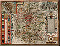 John Speed Wiltshire.jpg 1,754 × 1,350; 3.85 MB
-
 Wiltonia sive comitatus Wiltoniensis Anglis Wil Shire (8643505182).jpg 800 × 659; 129 KB
-
 "Wiltonia sive Comitatus Wiltoniensis. Anglis Wil Shire" (22064491430).jpg 3,686 × 3,060; 2.13 MB
-

-
 Maps of England circa 1670, Wiltshire 38 of 40 (13432166465).jpg 6,298 × 4,971; 4.21 MB
-
 Aikin(1800) p359 - Wiltshire.jpg 1,070 × 1,925; 363 KB
-
 Gray1824.wilts.jpg 816 × 989; 172 KB
-
 Pigot and Co (1842) p1.584 - Map of Wiltshire.jpg 1,293 × 2,172; 873 KB
-
 CAPPER(1813) p1116 - Wiltshire.jpg 1,359 × 2,326; 859 KB
-
 Wiltonia sive Comitatus Wiltoniensis anglis Wil Shire - CBT 6599257.jpg 5,635 × 4,554; 7.46 MB

.jpg)
.jpg)
.5.(8).jpg)
.jpg)
_p359_-_Wiltshire.jpg)

_p1.584_-_Map_of_Wiltshire.jpg)
_p1116_-_Wiltshire.jpg)
