Category:Old county maps of Staffordshire
Jump to navigation
Jump to search
Ceremonial counties of England: Bedfordshire · Berkshire · Buckinghamshire · Cambridgeshire · Cheshire · Cornwall · Derbyshire · Devon · Dorset · Durham · East Riding of Yorkshire · Essex · Gloucestershire · Hampshire · Herefordshire · Hertfordshire · Kent · Lancashire · Leicestershire · Lincolnshire · Norfolk · Northamptonshire · Northumberland · Nottinghamshire · Oxfordshire · Rutland · Shropshire · Somerset · Staffordshire · Suffolk · Surrey · Warwickshire · Wiltshire · Worcestershire
City-counties:
Former historic counties: Cumberland · Huntingdonshire · Middlesex · North Riding of Yorkshire · Sussex · West Riding of Yorkshire · Westmorland · Yorkshire
Other former counties:
City-counties:
Former historic counties: Cumberland · Huntingdonshire · Middlesex · North Riding of Yorkshire · Sussex · West Riding of Yorkshire · Westmorland · Yorkshire
Other former counties:
Media in category "Old county maps of Staffordshire"
The following 10 files are in this category, out of 10 total.
-
 Staffordshire - John Speed map 1610.jpg 6,586 × 5,001; 4.71 MB
-

-
 Wenceslas Hollar - Staffordshire (State 3).jpg 3,157 × 2,285; 2.47 MB
-
 "Staffordiensis comitatus, vulgo Stafford Shire" (22072137638).jpg 3,697 × 3,069; 1.98 MB
-

-
 Maps of England circa 1670, Stafford Shire 33 of 40 (13432256853).jpg 6,298 × 4,971; 4.22 MB
-
 Aikin(1800) p165 - Staffordshire.jpg 1,070 × 1,900; 367 KB
-
 Gray1824.staffs.jpg 811 × 979; 157 KB
-
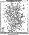
 Pigot and Co (1842) p2.380 - Map of Staffordshire.jpg 1,310 × 2,158; 933 KB
-
 Salopiensis comitatus cum Staffordiensi Shropshire & Staffordshire - CBT 6596650.jpg 5,945 × 4,715; 8.53 MB

.jpg)
.jpg)
.jpg)
.5.(33).jpg)
.jpg)
_p165_-_Staffordshire.jpg)

_p2.380_-_Map_of_Staffordshire.jpg)
