Category:Web mapping
Jump to navigation
Jump to search
process of using the maps delivered by geographic information systems (GIS) in World Wide Web  | |||||
| Upload media | |||||
| Instance of |
| ||||
|---|---|---|---|---|---|
| Subclass of |
| ||||
| Partially coincident with |
| ||||
| |||||
Subcategories
This category has the following 9 subcategories, out of 9 total.
Media in category "Web mapping"
The following 7 files are in this category, out of 7 total.
-
 Amenity-school-icon.png 500 × 500; 9 KB
-
 DeepStateMap.Live map on 25 April 2022.jpg 1,200 × 582; 117 KB
-
 DRR-web-map-Marica-RJ-20240207.png 1,076 × 554; 597 KB
-
 Geological-emergency-siren-icon.png 500 × 500; 7 KB
-
 Hidrological-emergency-siren-icon.png 500 × 500; 7 KB
-
 Macarte.png 1,024 × 1,024; 541 KB
-
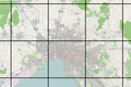 Tiled web map Stevage.png 1,802 × 1,204; 2.53 MB


