<nowiki>mapeado colaborativo; супольная картаграфія; совместное создание карт; Collaborative Mapping; mapeamento colaborativo; քարտեզների համատեղ ստեղծում; 协作地图; kolaborativno kartiranje; 共同マッピング; collaborative cairttin; Картографско сътрудничество; соработна картографија; 協作地圖; 協作地圖; kunlabora mapigado; iş birliğine dayalı haritalama; collaboratieve cartografie; collaborative mapping; عمل خرائط تشاركي; συνεργατική χαρτογράφιση; mappatura collaborativa; bir grup birey veya kuruluş ya da kullanıcı tarafından oluşturulan, web haritalarının içeriğinin farklı biçimlerde toplanmasına verilen isim; l'agrégation de la cartographie Web et du contenu généré par les utilisateurs, à partir d'un groupe d'individus ou d'entités; aggregation of web maps and user-generated content, from a group of individuals or entities, and can take several distinct forms; l'aggregazione di Web mapping e contenuti generati dagli utenti, da un gruppo di individui o entità; gemeinschaftliches Erstellen einer Karte; de aggregatie van webmapping en door gebruikers gegenereerde inhoud van een groep individuen of entiteiten; işbirliğine dayalı haritalama; işbirlikçi haritalama; ortak düzenlenen harita; citizen mapping; Kollaborative Kartenerstellung; 地圖協作計劃; супольнае стварэньне мапаў; kunlabora mapigo; χαρτογράφηση συνεργασίας; 地圖協作計畫</nowiki>
collaborative mapping
aggregation of web maps and user-generated content, from a group of individuals or entities, and can take several distinct forms
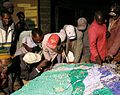 Cartografiaparticipativa.jpg 761 × 603; 170 KB
 Cartography barnstar.png 550 × 550; 811 KB
 OpenStreetMap per la didattica.pdf 1,500 × 1,125, 37 pages; 2.6 MB
 Palestra Open Data Day YouyhMappers UFBA 2024.png 1,141 × 639; 254 KB

