Category:Maps of islands in the United States
Jump to navigation
Jump to search
Subcategories
This category has the following 12 subcategories, out of 12 total.
Media in category "Maps of islands in the United States"
The following 18 files are in this category, out of 18 total.
-
 Anacapaislandmap.png 700 × 500; 487 KB
-
 Cat Island map.png 1,258 × 958; 181 KB
-
 Galveston island 0001.png 534 × 566; 34 KB
-
-
-
 Largest US Islands.jpg 3,648 × 2,640; 763 KB
-
 Mississippi-Alabama barrier islands.png 1,677 × 623; 262 KB
-
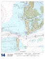 Mullet Key chart.pdf 1,275 × 1,650; 405 KB
-
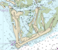 Mullet Key detail.png 477 × 409; 200 KB
-
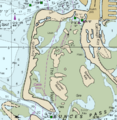
 Pine Island, Lake Livingston, Texas.png 873 × 582; 378 KB
-

-
 Rock Island, IL, 1820 (Saukenuk).jpg 400 × 544; 79 KB
-
 Santa-barbara-island-nps-map.PNG 485 × 425; 16 KB
-
 Santa-rosa-island-nps-map.PNG 450 × 277; 16 KB
-
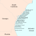
 Sea Islands map.png 376 × 377; 21 KB
-
 Sea Islands map.svg 1,232 × 1,253; 474 KB
-
 Shell Key detail.png 280 × 287; 91 KB
-
 Sucia Island Map.png 1,168 × 882; 818 KB


.jpg)


