Category:Maps of Roman Gaul
Jump to navigation
Jump to search
Wikimedia category | |||||
| Upload media | |||||
| Instance of | |||||
|---|---|---|---|---|---|
| Category combines topics | |||||
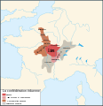
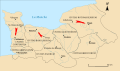
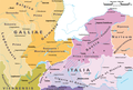
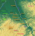
| Roman Gaul | |||||
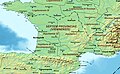
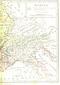
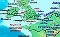
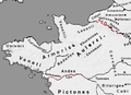
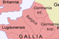
Gaul as a province of the Roman Empire | |||||
| Instance of | |||||
| Culture |
| ||||
| Location |
| ||||
| Has part(s) | |||||
| Inception |
| ||||
| |||||
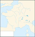
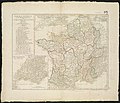
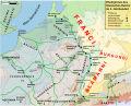
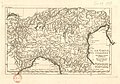
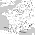
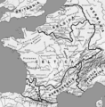
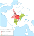
Modern and old maps showing Gaul during the Roman Empire.
Subcategories
This category has the following 6 subcategories, out of 6 total.
*
A
- Maps of Augustodunum (9 F)
L
- Maps of Lugdunum (9 F)
M
- Maps of Gauls in the 5th-century (10 F)
S
- Siagrius kingdom (486) (12 F)
Media in category "Maps of Roman Gaul"
The following 95 files are in this category, out of 95 total.
-
 18 of '(A History of the Romans under the Empire.)' (11038685425).jpg 3,098 × 2,581; 1.53 MB
-
 400 Aquitania I, II, III and Narbonenis I.jpg 905 × 561; 245 KB
-
 400 Germania I II Belgica I II.png 522 × 461; 263 KB
-
 554 of 'A History of Rome ... New edition' (11247510466).jpg 1,450 × 2,028; 789 KB
-
 555 of 'A History of Rome ... New edition' (11246481635).jpg 1,431 × 2,028; 809 KB
-
 56 of 'Cæsar's Conquest of Gaul' (11250615953).jpg 5,722 × 4,912; 6.04 MB
-

-
 Amorica.JPG 294 × 184; 18 KB
-
 Aquitani.png 481 × 393; 10 KB
-
 Aquitania 002.png 568 × 590; 256 KB
-
 Armorica.png 395 × 286; 32 KB
-
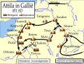
 Attila in Gaul 451CE-de.svg 1,292 × 989; 553 KB
-
 Attila in Gaul 451CE-es.svg 1,283 × 981; 170 KB
-
 Attila in Gaul 451CE-fr.svg 1,280 × 977; 420 KB
-
 Attila in Gaul 451CE-hu.svg 1,292 × 989; 359 KB
-
 Attila in Gaul 451CE-it.svg 1,283 × 981; 392 KB
-
 Attila in Gaul 451CE-nl.svg 1,283 × 981; 444 KB
-
 Attila in Gaul 451CE-pt.svg 1,283 × 981; 170 KB
-
 Attila in Gaul 451CE-ru.png 1,362 × 1,039; 295 KB
-
 Attila in Gaul 451CE-zh.svg 512 × 391; 158 KB
-
 Attila in Gaul 451CE.svg 1,283 × 981; 511 KB
-
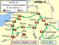
 Bataille des champs Catalauniques sr.svg 1,280 × 977; 158 KB
-
 Battaglia dei Campi Catalaunici.svg 840 × 745; 107 KB
-
 Bavai-cologne2.jpg 1,000 × 378; 223 KB
-
 Belgica Secunda.jpg 591 × 672; 157 KB
-
 Belgica1.png 200 × 134; 5 KB
-
 Blank map of Gaul 1st century BC.svg 755 × 784; 44 KB
-
 Bretagne-Pays de la Loire - Empire romain - Capitale de cités et cités.svg 3,479 × 1,869; 130 KB
-
 Carausian Revolt Map.jpg 802 × 546; 26 KB
-
 Carte de la Gaule Narbonnaise.jpg 499 × 303; 140 KB
-
 Carte de la gaule à l'époque romaine.gif 1,404 × 904; 62 KB
-
 Celtictribes58-50.jpg 660 × 590; 110 KB
-
 Celtictribes58-50.svg 754 × 686; 68 KB
-
 Cesare prima Gallia 58 a.C.jpg 1,704 × 1,181; 633 KB
-
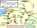
 Chalons disposition.jpg 621 × 725; 98 KB
-
 D499-Voies des Gaules.-Liv2-ch10.png 1,446 × 1,588; 240 KB
-
 Decumates.jpg 1,668 × 3,188; 6.75 MB
-
 Droysens Hist Handatlas S16 Gallien CAESAR.png 788 × 772; 1.28 MB
-

-
 EmpireOfGaul.png 512 × 428; 71 KB
-
 Espace Lémovices.jpg 1,978 × 1,938; 2.24 MB
-
 Gallia - Geschichtskarte von Frankreich.jpg 9,278 × 6,805; 17.79 MB
-
-
 Gallia Antiqua.jpg 8,516 × 7,090; 17.27 MB
-
 Gaul IVth century AD de.svg 972 × 780; 881 KB
-
 Gaul IVth century AD-es.svg 512 × 411; 828 KB
-
 Gaul IVth century AD-pt.svg 512 × 411; 200 KB
-
 Gaul IVth century AD.svg 972 × 780; 1.21 MB
-
 Gaul, 1st century BC hu.svg 825 × 769; 435 KB
-
 Gaul, 1st century BC.gif 825 × 769; 72 KB
-
 Gaule -54.png 1,318 × 1,559; 1.1 MB
-
 Gaule -55.png 1,318 × 1,559; 1.12 MB
-
 Gaule Belgique.png 498 × 363; 113 KB
-
 Germania 70 de.svg 972 × 780; 1.47 MB
-
 Germania 70-es.svg 972 × 780; 1.17 MB
-
 Germania 70-hu.svg 972 × 780; 686 KB
-
 Germania 70-pt.svg 972 × 780; 685 KB
-
 Germania 70.svg 972 × 780; 1.64 MB
-
 Germáni a Galie (kolem 300).png 630 × 479; 85 KB
-
 Heedut.svg 729 × 709; 257 KB
-
 History of France-1.jpg 671 × 1,085; 99 KB
-
 Image taken from page 531 of 'Histoire universelle' (11147289716).jpg 2,208 × 1,407; 706 KB
-
 Karte Vicus Orsingen.png 2,230 × 1,494; 2.38 MB
-
 Kingdom Soissons 476.jpg 1,800 × 1,632; 666 KB
-
-
 La gaule romaine.jpg 504 × 482; 58 KB
-
 Map Gallia Tribes Towns-es.svg 1,450 × 1,460; 2.37 MB
-
 Map Gallia Tribes Towns-la.svg 1,450 × 1,460; 2.33 MB
-
 Map Gallia Tribes Towns.png 787 × 799; 352 KB
-
 Map of Eduens people-es.svg 755 × 784; 374 KB
-
 Map of Eduens people-fr.svg 755 × 784; 75 KB
-
 Map of Eduens people-it.svg 755 × 784; 76 KB
-
 Map of the Gallic Empire, 260 AD.jpg 2,052 × 1,414; 1.04 MB
-
 MapGalliaParts.png 787 × 798; 130 KB
-
 Namnetes.jpg 787 × 799; 1.42 MB
-
 Normandie - Bas-Empire romain - Cités et capitales des cités-es.svg 3,532 × 2,104; 651 KB
-
 Normandie - Bas-Empire romain - Cités et capitales des cités.svg 3,532 × 2,104; 287 KB
-
 Normandie - Haut-Empire romain - Cités et capitales des cités.svg 3,532 × 2,104; 297 KB
-
 Normandie - Haut-Empire romain - Saint-Aubin-sur-Mer.svg 3,532 × 2,104; 299 KB
-
 Oppidum Ensérune, Grundriss, östl. Hälfte.jpg 2,284 × 1,363; 713 KB
-
 Oppidum Ensérune, Lageplan.jpg 1,626 × 1,626; 614 KB
-
 Oppidum gaulois de Castrum Caninum (Château-Chinon).svg 972 × 1,211; 1.29 MB
-
 Plan général de l'oppidum d'Ensérune en 2011.jpg 1,860 × 548; 662 KB
-
 PSM V51 D457 Races of historic gaul.png 1,012 × 932; 431 KB
-
 Roemische Provinzen Alpenraum ca 14 n Chr.jpg 2,000 × 1,351; 1.03 MB
-
 Roman Gaul - AD 400-zh.svg 1,264 × 771; 1.43 MB
-
 Roman Gaul - AD 400.png 1,369 × 833; 1.13 MB
-
 Römische Provinzen im Alpenraum 395 n Chr.png 2,500 × 1,688; 659 KB
-
 Römische Provinzen im Alpenraum ca 14 n Chr.png 2,497 × 1,688; 739 KB
-
 Römische Provinzen im Alpenraum ca 150 n Chr.png 2,500 × 1,688; 1,001 KB
-
 The Aedui and their allies-la.svg 755 × 784; 111 KB
-
 Tongre-Cologne.jpg 1,604 × 538; 871 KB
-
 Ubiens.jpg 485 × 499; 435 KB
-
 Éduens.svg 729 × 709; 258 KB
-
 Éduenscarte.svg 729 × 709; 265 KB
%27_(11038685425).jpg)


.jpg)
.jpg)
.jpg)


.jpg)


.png)


.jpg)


.svg)


%27_(11001473636).jpg)