Category:Maps of Australia
Jump to navigation
Jump to search
Countries of Oceania: Australia · Fiji · Federated States of Micronesia · Kiribati · Marshall Islands · Nauru · New Zealand · Palau · Papua New Guinea · Samoa · Solomon Islands · Tonga · Tuvalu · Vanuatu
Other areas: American Samoa · Clipperton Island · Cocos (Keeling) Islands · Cook Islands · French Polynesia · Guam · Hawaii · New Caledonia · Niue · Norfolk Island · Northern Mariana Islands · Pitcairn Islands · Tokelau · Wallis and Futuna – Partly: British overseas territories · Overseas France · Indonesia · French Southern and Antarctic Lands · United States Minor Outlying Islands
Other areas: American Samoa · Clipperton Island · Cocos (Keeling) Islands · Cook Islands · French Polynesia · Guam · Hawaii · New Caledonia · Niue · Norfolk Island · Northern Mariana Islands · Pitcairn Islands · Tokelau · Wallis and Futuna – Partly: British overseas territories · Overseas France · Indonesia · French Southern and Antarctic Lands · United States Minor Outlying Islands
| Upload media | |||||
| Instance of |
| ||||
|---|---|---|---|---|---|
| Main subject | |||||
| |||||
Subcategories
This category has the following 50 subcategories, out of 50 total.
- Animated maps of Australia (10 F)
- Blank maps of Australia (10 F)
- Toponymic maps of Australia (2 F)
!
*
A
B
C
- Campus maps of Australia (1 F)
D
- Maps of deserts of Australia (8 F)
E
- ECHO Daily Maps of Australia (21 F)
F
G
H
L
M
- Maps of Australian Alps (4 F)
O
P
R
S
T
- Time zone maps of Australia (13 F)
- Topographic maps of Australia (34 F)
W
Pages in category "Maps of Australia"
The following 2 pages are in this category, out of 2 total.
Media in category "Maps of Australia"
The following 200 files are in this category, out of 392 total.
(previous page) (next page)-
 'ndrangheta in Australia 2017.jpg 1,074 × 752; 68 KB
-

-
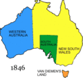
 1846 Eastern Australia state boundaries.jpg 300 × 495; 28 KB
-

-
 1893 Parrott - Newcastle - nla.obj-232126191.jpg 8,535 × 10,278; 16.43 MB
-
 1997anomaly.gif 680 × 467; 67 KB
-
 2002decileanomaly - new.gif 680 × 467; 69 KB
-
 2006decileanomaly - new.gif 680 × 467; 70 KB
-
 2009decileanomaly - new.gif 680 × 467; 68 KB
-
 2010decileanomaly.gif 680 × 467; 64 KB
-

-

-
 Aagis-zones-regions.png 600 × 483; 151 KB
-
 ACA-dioceses-blank.png 1,000 × 900; 101 KB
-
 Acropoma japonicum map.jpg 460 × 306; 173 KB
-
 ACT-Jervis Bay-Sydney-MJC.png 1,000 × 1,172; 45 KB
-
 Admiralty Chart Catalogue 1967 Page 076 Index M.jpg 8,568 × 6,832; 9.17 MB
-
 Admiralty Chart Catalogue 1967 Page 079 Index M1.jpg 8,567 × 6,844; 8.23 MB
-
 Air League states.png 289 × 262; 6 KB
-
 AirLeagueStates2.png 290 × 263; 10 KB
-
 An atlas of commercial geography (1913) (14594767000).jpg 2,880 × 2,412; 1.63 MB
-
 Anilios-bituberculatus-range-distribution-map.jpg 450 × 415; 93 KB
-
 As-map hobart.png 329 × 353; 32 KB
-
 As-map ita.png 325 × 383; 17 KB
-
 As-map-ja.png 328 × 352; 19 KB
-
 As-map-no.png 329 × 353; 63 KB
-
 As-map-zh-cn.png 329 × 353; 75 KB
-
 As-map.png 329 × 353; 21 KB
-
 Ashburnham County (NSW) map of 1886.png 604 × 395; 431 KB
-
 Aus circles.PNG 435 × 435; 18 KB
-
 AUS locator map with corners full.png 1,361 × 1,231; 166 KB
-
 AUS locator map with corners full.svg 1,361 × 1,231; 107 KB
-
 AUS locator map with corners.png 1,361 × 1,231; 143 KB
-
 Aus map south australia circled.png 1,200 × 1,082; 527 KB
-
 Aus map.png 316 × 235; 18 KB
-
 AUS orthographic.svg 550 × 550; 761 KB
-
 Aus1.png 1,008 × 785; 1,002 KB
-
 AusIndustry locations.png 847 × 658; 581 KB
-
 Austraalia.jpg 900 × 732; 523 KB
-
 Australia 'ndrangheta.gif 1,088 × 972; 46 KB
-
 Australia 1.png 166 × 142; 13 KB
-
 Australia 3.png 166 × 139; 15 KB
-
 Australia 4.png 167 × 140; 15 KB
-
 Australia Agriculture-Forestry-Fishing-Hunting Map-sr.svg 1,146 × 840; 2.31 MB
-
 Australia average rainfall in Dec 2019 map.png 1,139 × 1,054; 72 KB
-
 Australia big things map.PNG 1,789 × 1,534; 98 KB
-
 Australia big things map.png 1,789 × 1,534; 96 KB
-
 Australia Boomerang Distribution.PNG 2,000 × 1,870; 128 KB
-
 Australia change 1947-11-01.png 1,000 × 967; 158 KB
-
 Australia dot.png 142 × 137; 6 KB
-
 Australia Eastern Territory (The Salvation Army) (map).jpg 533 × 490; 29 KB
-
 Australia Exclusive Economic Zones.png 2,410 × 1,178; 154 KB
-
 Australia featuring broken hill.png 200 × 186; 8 KB
-
 Australia forest cover by Global Ecological Zones.tif 3,508 × 2,480; 8.3 MB
-
 Australia four Corners surveyors etc.PNG 500 × 421; 36 KB
-
 Australia four Corners surveyors etc.svg 500 × 421; 35 KB
-
 Australia Fractal.jpg 5,116 × 4,390; 2.51 MB
-
 Australia GHI mid-size-map 156x171mm-300dpi v20191205.png 1,842 × 2,020; 1.31 MB
-
 Australia GI map ukrainian.svg 2,179 × 1,950; 560 KB
-
 Australia Global Horizontal Irradiance map.png 1,842 × 2,008; 1.88 MB
-
 Australia grid.png 614 × 559; 52 KB
-
 Australia ive been everywhere.PNG 1,661 × 1,600; 72 KB
-
 Australia locator Bass Strait.png 469 × 439; 18 KB
-
 Australia map (ky).svg 351 × 327; 55 KB
-
 Australia map blacked.png 1,770 × 1,770; 321 KB
-
 Australia map maritime zones uk.tif 800 × 730; 2.29 MB
-
 Australia map maritime zones.png 800 × 730; 78 KB
-
 Australia map.png 330 × 354; 22 KB
-
 Australia mapa.png 1,517 × 1,199; 1.38 MB
-
 Australia max.png 142 × 137; 7 KB
-
 Australia Mining Industry-Energetics Map-sr.svg 1,146 × 840; 531 KB
-
 Australia ndrangheta 2017.jpg 1,955 × 1,795; 169 KB
-
 Australia ndrangheta.gif 1,088 × 972; 45 KB
-
 Australia OCHA map.jpg 494 × 492; 134 KB
-
 Australia plain.png 142 × 137; 5 KB
-
 Australia q.png 142 × 136; 6 KB
-
 Australia regions.png 142 × 137; 7 KB
-
 Australia satellite plane.jpg 5,250 × 4,320; 1.76 MB
-
 Australia satellite states.jpg 1,024 × 768; 182 KB
-
 Australia SDG artwork - Jordana Angus.png 800 × 470; 175 KB
-
 Australia States Map - Colours.svg 658 × 602; 59 KB
-
 Australia true.png 142 × 136; 8 KB
-
-
 Australia, Anna Creek Station.png 604 × 469; 80 KB
-
 Australia-coloured-locator.png 334 × 256; 5 KB
-
 Australia-easttimor-border.png 4,096 × 2,560; 814 KB
-
 Australia-ecoregion SW.png 623 × 469; 7 KB
-
 Australia-ecoregions SW subdivisions.png 623 × 469; 8 KB
-
 Australia-Greenland Overlay.png 520 × 463; 23 KB
-
 Australia-Greenland size comparison (bn).svg 383 × 364; 535 KB
-
 Australia-Greenland size comparison hu.svg 383 × 364; 583 KB
-
 Australia-Greenland size comparison.svg 383 × 364; 582 KB
-
 Australia-płonie.jpg 655 × 655; 85 KB
-
 AustraliaFractal.jpg 5,116 × 4,390; 2.49 MB
-
 AustraliaMap Extremities.PNG 800 × 576; 82 KB
-
 AustraliaMapArid&Cotton.jpg 1,192 × 908; 98 KB
-
 Australian building industry 2010.png 887 × 959; 117 KB
-
 Australian Capital Territory in Australia zoom.svg 1,600 × 1,438; 50 KB
-
 Australian external territories-ang.png 644 × 376; 10 KB
-
 Australian external territories-el.png 644 × 376; 10 KB
-
 Australian external territories-eu.png 644 × 376; 10 KB
-
 Australian external territories-fi.png 644 × 376; 10 KB
-
 Australian external territories-fr.png 644 × 376; 10 KB
-
 Australian external territories-hr.png 644 × 376; 10 KB
-
 Australian external territories-it.png 644 × 376; 10 KB
-
 Australian external territories-ja.png 644 × 376; 19 KB
-
 Australian external territories-mrj.png 644 × 376; 11 KB
-
 Australian external territories-nl.png 644 × 376; 10 KB
-
 Australian external territories-no.png 644 × 376; 10 KB
-
 Australian external territories-uk.png 644 × 376; 10 KB
-
 Australian external territories-vi.png 644 × 376; 11 KB
-
 Australian external territories.png 644 × 376; 14 KB
-
 Australian Extremities.png 2,190 × 1,652; 156 KB
-
 Australian Federal electorates2.PNG 1,555 × 641; 76 KB
-
 Australian forest cover.tif 3,508 × 2,480; 8.3 MB
-
 Australian forest types.tif 3,508 × 2,480; 8.3 MB
-
 Australian Heatwave 2017 Satellite Imagery.png 720 × 598; 310 KB
-
 Australian local government areas 2023.svg 800 × 390; 44.87 MB
-
 Australian Map Extremities.svg 1,000 × 720; 152 KB
-
 Australian ocean currents.png 550 × 358; 161 KB
-
 Australian political divisions revised.jpg 1,561 × 1,637; 126 KB
-
 Australian population density 2016.png 7,015 × 4,965; 677 KB
-
 Australian reed warbler distribution map.jpg 7,016 × 4,151; 714 KB
-
 Australian reed warbler species distribution map.jpg 2,080 × 1,376; 131 KB
-
 Australian Sprat Region Map.png 600 × 431; 63 KB
-
 Australian States and Territories with CDS.jpg 350 × 395; 39 KB
-
 Australian states history 06.gif 300 × 279; 9 KB
-
 Australian states history 07.gif 300 × 279; 8 KB
-
 Australian states history 16.png 300 × 279; 11 KB
-
 Australian wine zones.png 300 × 275; 5 KB
-
 Australian wine zones2.png 1,000 × 917; 169 KB
-
 AustralianMapinArabic.svg 595 × 500; 13 KB
-
 AustraliaNumbered1788.png 300 × 279; 16 KB
-
 AustraliaNumbered1825.png 300 × 279; 16 KB
-
 Australie sud-ouest.png 720 × 438; 25 KB
-
 Australie Écorégions.jpg 3,508 × 2,480; 686 KB
-
 Australien-Outback.png 1,843 × 1,814; 1.35 MB
-
 Australien-Vegetation.png 1,843 × 1,814; 1.11 MB
-
 Australienterrain.png 3,507 × 2,480; 2.57 MB
-
 Autralian colonies before 1825 deutsch.svg 2,055 × 1,846; 267 KB
-
 Average daily maximum temperature in Januar in Australia.svg 400 × 371; 31 KB
-
 Average daily maximum temperature in July in Australia.svg 400 × 371; 23 KB
-
 Avstraliya çəpəri.png 497 × 364; 198 KB
-
 Bell Miner Distribution From Atlas Living Australia.png 400 × 400; 15 KB
-
 Bistum Broken Bay.svg 512 × 512; 25 KB
-
 Bistum Lismore.svg 512 × 512; 25 KB
-
 Bistum Maitland-Newcastle.svg 512 × 512; 25 KB
-
 Black and white Australia map.jpg 1,225 × 998; 386 KB
-
 Blank Australia map with inhabited external territories.png 2,608 × 2,395; 167 KB
-
 BOM Radars Range Map 2022.jpg 3,847 × 2,566; 407 KB
-
 BOM002 Map Poster A3 Web.png 1,653 × 1,169; 1.01 MB
-
 Books Australia.png 821 × 799; 223 KB
-
 Books Australia2.png 821 × 799; 228 KB
-
-
 Cane toad distribution stills.png 703 × 592; 32 KB
-
 Cannabis Encyclopedia (Gaiduk) Pictures 003.png 1,163 × 833; 649 KB
-
 Carte générale de l'Australie (33746335464).jpg 1,200 × 897; 476 KB
-
 CDS AUS.png 1,280 × 900; 118 KB
-
 Channel Country.JPG 1,047 × 851; 154 KB
-
 Channel Country.pdf 1,045 × 850; 151 KB
-
 Clarence County (NSW) map.png 435 × 389; 263 KB
-
 Climate features of Australia - just roughly.svg 455 × 379; 24 KB
-
 Coldest temperatures recorded in Australian States and Territories.png 6,000 × 5,655; 1.38 MB
-
 Consequences of a failure link.JPG 1,124 × 754; 89 KB
-
 Cryptagama aurita distribution.png 279 × 245; 3 KB
-
 CSIRO ScienceImage 2384 Two People Around a Laptop.jpg 3,506 × 2,481; 1.03 MB
-
 CSIRO ScienceImage 3853 Map of CSIRO sites.jpg 2,657 × 1,879; 1.29 MB
-
-
 Ctenophorus isolepis distribution.png 279 × 245; 3 KB
-
 Cyclorana australis distrib.png 300 × 275; 3 KB
-
 Daily rainfall history in Australia from March 17 to March 24, 2021.gif 1,360 × 972; 1.74 MB
-
 Darling Lachlan Murrumbidgee Murray Rivers.png 2,000 × 1,678; 1.7 MB
-
 Deep Lakes Projects in Australia eastern deserts.jpg 4,160 × 3,120; 4.23 MB
-
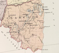
 Denham County 1876 map.png 473 × 417; 245 KB
-
 Desertic Biomes in Australia.png 720 × 438; 35 KB
-
 Dioceses of Anglican Church of Australia, 2019.jpg 1,001 × 901; 43 KB
-
-
 Distribution map of Chelodina species.png 675 × 527; 155 KB
-
 Distribution map of Chestnut Quail-Thrush.jpg 422 × 384; 21 KB
-
 Distribution of Chalinolobus nigrogriseus.png 2,025 × 2,388; 185 KB
-
 Distribution of Daviesia latifolia.png 616 × 584; 48 KB
-
 Distribution of Mormopterus planiceps.png 538 × 510; 45 KB
-
 Distribution Plebs eburnus.jpeg 1,176 × 1,088; 119 KB
-
 Distribution range Strophurus williamsi.png 678 × 609; 208 KB
-
 Distribution within Australian waters.jpg 700 × 466; 59 KB
-
 DonThomsonLifeworksAustraliaMap.JPG 5,104 × 7,016; 1.54 MB
-
 Dowling County Map of 1886.png 598 × 434; 466 KB
-
 Drainage Divisions of Australia.svg 941 × 869; 293 KB
-
 Dwarf Spotted Wobbegong Range.png 206 × 148; 5 KB
-
 E. cordata.JPG 702 × 574; 25 KB
-
 E. olsenii.JPG 702 × 574; 26 KB
-
 E.bidawalus-dist.png 300 × 271; 32 KB
-
 E.yanga.jpg 300 × 271; 11 KB
-
 Early map of Australia.jpg 2,448 × 3,264; 2.35 MB
-
 Eastern Angelshark Range.png 206 × 140; 6 KB
-
 EB1911 Australia Map joined.jpg 2,276 × 1,617; 2 MB
-
 EEZs Pacific.png 863 × 624; 56 KB
-
 Empodisma minus distribution map.jpg 2,080 × 1,354; 104 KB
-
 Enhydrina zweifeli.png 427 × 306; 165 KB
-
 Eromanga Sea.png 1,955 × 1,795; 444 KB

%27_(11247035874).jpg)


.jpg)
.jpg)


_(14594767000).jpg)


_map_of_1886.png)


_(map).jpg)


.svg)


.svg)


_(1886)_(20587846666).jpg)

_Pictures_003.png)
.jpg)


_map.png)


.jpg)


