Category:Maps facing West
Jump to navigation
Jump to search
English: This category is to collect maps where West is on top while North is to the right.
Subcategories
This category has the following 14 subcategories, out of 14 total.
E
M
Media in category "Maps facing West"
The following 94 files are in this category, out of 94 total.
-
 *another map of the British Isles* (1600).jpg 800 × 600; 130 KB
-
 Guang yu tu - er juan LOC 2008623187-36.jpg 4,360 × 4,658; 5.07 MB
-
 Guang yu tu - er juan LOC 2008623187-36.tif 4,360 × 4,658; 58.1 MB
-
 Guang yu tu - er juan LOC 2008623187-37.jpg 4,360 × 4,658; 4.53 MB
-
 Guang yu tu - er juan LOC 2008623187-37.tif 4,360 × 4,658; 58.1 MB
-
 Guang Yutu 1558 Vol 2 Pg 96 Mouth of the Yalu.jpg 1,020 × 720; 232 KB
-

-
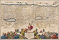
 FLAMINUS(1681) p204 Nr.7 - PALESTINA VEI TERRA SANCTA.jpg 5,229 × 3,798; 9.14 MB
-
 Ca. 1690 map of Moses' travel from Egypt to Canaan.jpg 11,183 × 7,495; 19.13 MB
-

-
-
 A chart of the NORTH SEA (NYPL b13909432-1640558).jpg 5,931 × 4,880; 7.99 MB
-

-

-

-
 El reyno de Valencia dividido en sus dos goviernos (1752).jpg 1,798 × 1,029; 1.04 MB
-
 1831 J. Langdon Pocket Map of New York City - Geographicus - NewYorkCity-langdon-1831.jpg 3,500 × 2,856; 2.85 MB
-
 Chōsen zenzu. LOC 2006626498.jpg 6,768 × 4,835; 5.55 MB
-
 1939 Post Office Wireless Stations - MacDonald Gill.png 18,371 × 14,611; 409.74 MB
-

-
 207 of 'The Annals of Albany. By Joel Munsell' (11032091674).jpg 1,927 × 1,168; 289 KB
-

-

-

-

-

-
 A map of the Black Sea by Gratioz Beninkazy, 1474.jpg 760 × 637; 117 KB
-

-
-
 Aegyptus antiqua - btv1b53171214z (1 of 2).jpg 6,339 × 4,684; 5.04 MB
-
-
 Afrique Barbarie (1665 map detail).jpg 2,950 × 3,316; 1.49 MB
-

-
 Atlas nautique de la Mer Méditerranée - btv1b5901101q (4 of 7).jpg 7,574 × 5,322; 4.63 MB
-

-

-

-
-
-
-
 Atlas Ortelius KB PPN369376781-026av-026br.jpg 3,000 × 2,194; 4.81 MB
-

-
 B26056005B - Molvccae insvlae celeberrimae.jpg 5,413 × 4,228; 7.88 MB
-
 Bay of Biscay - Mount & Page - btv1b531531922 (1 of 2).jpg 6,350 × 7,360; 5.27 MB
-

-
 Blaeu 1645 - Coloniensis Archiepiscopatus-2.jpg 3,001 × 2,333; 1.38 MB
-
-
 Bodleian Libraries, The western half of a normalportolan chart.jpg 1,000 × 675; 164 KB
-
 Ca. 1690 map of the Holy Land by Daniel Stoopendaal.jpg 11,144 × 7,500; 16.8 MB
-
 Carte Corse 1768.png 2,781 × 1,417; 10.63 MB
-

-
 Circulus Westphalicus, sive Germaniae inferioris (8343030088).jpg 800 × 662; 146 KB
-
 Corse 1769.png 3,939 × 1,860; 17.56 MB
-
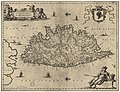
 Corsica - Porcacchi Tomaso - 1620.jpg 1,500 × 1,090; 1.37 MB
-

-
 Dresden1750.jpg 2,385 × 1,792; 1.93 MB
-
 East Mediterranean and Black Sea RMG F1790.tiff 6,867 × 5,219; 102.54 MB
-
 Europe from Moscow - Asia from Irkutsk.jpg 9,500 × 6,310; 29.38 MB
-
 Gascoyne, Country of Carolina.jpg 1,784 × 1,471; 1.08 MB
-
 Golfo de Biscaia no atlas de Guillaume Brouscon (1540-1560).jpg 3,303 × 4,672; 9.24 MB
-
 Insulae Corsicae noua & accurata descriptio - CBT 5882492.jpg 5,739 × 4,427; 6.99 MB
-
 Insulae Corsicae nova et accurata descriptio - btv1b531777267 (1 of 2).jpg 6,090 × 4,660; 4.63 MB
-
 Island of Zante - Goodisson William - 1822.jpg 1,500 × 1,003; 655 KB
-
-

-

-
 Joseph Moxon. Canaan, or The Land of promise. 1700.jpg 5,899 × 4,083; 15.71 MB
-

-

-
 M0212 AG-2017-0-6167-U Carte des relais de Paris à Brest.jpg 1,930 × 2,500; 2.96 MB
-
 Manuel de Mesquita Perestrelo00.jpg 816 × 1,108; 160 KB
-
 Map of ancient Egypt and inset map of the area around Alexandria by Abraham Ortelius.jpeg 3,070 × 2,370; 2.36 MB
-
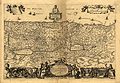
 Map of Switzerland (1600) north east.jpg 800 × 600; 165 KB
-
 Map of Switzerland (1600) south east.jpg 800 × 600; 178 KB
-
 Map of Switzerland (1600) south west.jpg 800 × 600; 152 KB
-
 Map of the Mediterranean Sea, west upside.jpg 1,616 × 2,800; 2.29 MB
-
 Map of the northern Rhine (1600).jpg 800 × 600; 122 KB
-
 Negreponte - Porcacchi Tomaso - 1620.jpg 1,500 × 1,123; 1.21 MB
-
 Northumberlandia map.svg 566 × 810; 116 KB
-
 Nova Europa; Pascaarte de Hugo Allardt (1670).jpg 8,036 × 6,498; 7.77 MB
-

-
 Pieter van der Aa Java 1720.jpg 450 × 732; 110 KB
-
 Polonia,Lithania,Livonia.jpg 1,600 × 1,176; 527 KB
-
 Print, book-illustration, map (BM 1977,U.367.1).jpg 2,500 × 2,000; 644 KB
-
 RusguniaEO.png 1,800 × 1,200; 3.68 MB
-
 Sjökort-Sjökort över Ceylon. Runt kartusch i nedre högra hörnet syns flera människor - Sjöhistoriska museet - 2007-006-43.tif 4,724 × 3,307, 2 pages; 23.63 MB
-

-
 SXDamaia.png 733 × 1,400; 568 KB
-

-
 Topographia Alsatiae (Merian) p 001.JPG 3,118 × 2,327; 2.18 MB
-
 UBBasel Map 1572 Kartenslg AA 20a Inghiltera (page 1 crop).tiff 2,238 × 1,626; 13.9 MB
-
 Atlas Minor Gerardi Mercatoris 1609 (106757883).jpg 5,912 × 4,727; 5.77 MB
-

-
 Россия. Крым. Карта с показанием крепостей, городов и дер. Кон.18в ГИМ e1.jpg 1,851 × 1,699; 666 KB
.jpg)


.jpg)
_p204_Nr.7_-_PALESTINA_VEI_TERRA_SANCTA.jpg)

.jpg)
.jpg)
.jpg)

.jpg)

.jpg)


%27_(11007819553).jpg)
.jpg)
.jpg)
)%27_(11015771943).jpg)
.jpg)
%27_(11301740036).jpg)

.jpg)
.jpg)
.jpg)
_1595_-_btv1b531968814_(2_of_3).jpg)
.jpg)
.jpg)
.jpg)
.jpg)
.jpg)
.jpg)
.jpg)
.jpg)
.jpg)

.jpg)

.jpg)
.jpg)


.jpg)
.jpg)


.jpg)

.jpg)


.jpg)


_north_east.jpg)
_south_east.jpg)
_south_west.jpg)

.jpg)


.jpg)


.jpg)


.jpg)
_p_001.JPG)
.jpg)
.jpg)

.jpg)
.jpg)
.jpg)