Category:CIA World Factbook maps of the world
Jump to navigation
Jump to search
Media in category "CIA World Factbook maps of the world"
The following 58 files are in this category, out of 58 total.
-
 "Political World" CIA World Factbook map 2005.svg 2,753 × 1,538; 2.38 MB
-
 1-12 Color Map World.png 4,572 × 2,500; 2.63 MB
-
 Antarctic Circle.jpg 634 × 311; 275 KB
-
 ARCTIC CIRCLE 021106.jpg 634 × 311; 275 KB
-
 CIA Political World Map 2002.jpg 3,206 × 1,698; 874 KB
-
 CIA World Factbook 2016 physical world map.svg 512 × 259; 13.61 MB
-
 CIA World Map Physical 2021.pdf 6,600 × 3,600; 3.64 MB
-
 CIA World Map Political 2021.pdf 6,300 × 3,600; 22.53 MB
-
 CIA World Physical Map (2023).pdf 6,600 × 3,600; 3.55 MB
-
 CIA World Political Map (2023).pdf 6,300 × 3,600; 8.02 MB
-
 CIA WorldFactBook-Political world ID Peta Dunia.svg 2,760 × 1,502; 1.57 MB
-
 CIA WorldFactBook-Political world pdf2svg.svg 512 × 277; 2.79 MB
-
 CIA WorldFactBook-Political world-ee.png 4,792 × 2,604; 2.54 MB
-
 CIA WorldFactBook-Political world.pdf 6,300 × 3,600; 23.25 MB
-
 CIA WorldFactBook-Political world.png 6,000 × 3,271; 4.39 MB
-
 CIA WorldFactBook-Political world.svg 2,760 × 1,502; 1.47 MB
-
 Cylindrical Equal-Area Projection Oblique Case Map of the World.png 634 × 270; 46 KB
-
 Dijagram Zemljopisne Sirine.PNG 717 × 306; 107 KB
-
 Exports by country map copy3.png 1,357 × 628; 54 KB
-
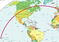 Flight path TN064.jpg 2,486 × 1,756; 661 KB
-
 Gdp real growth rate 2007 CIA Factbook.PNG 1,350 × 625; 50 KB
-
 GDP real growth rate CIA Factbook.PNG 1,350 × 625; 50 KB
-
 Map of the world 1998.jpg 11,527 × 6,505; 7.54 MB
-
 Map of the world by the US Gov as of 2016 no legend.svg 3,464 × 1,755; 21.61 MB
-
 Map of the world with countries and dependencies.svg 512 × 278; 2.95 MB
-
 Physical Map of the World (2021).svg 1,800 × 912; 17.19 MB
-
 Physical World Map.svg 1,920 × 973; 8.1 MB
-
 Physical world.svg 3,168 × 2,448; 14.22 MB
-
 Political Map of the World (august 2013).png 11,479 × 6,269; 5.35 MB
-
 Political Map of the World (august 2013).svg 3,464 × 1,897; 12.18 MB
-
 Political Map of the World (january 2015).pdf 6,600 × 5,100; 1.5 MB
-
 Political Map of the World (january 2015).png 17,392 × 9,478; 16.84 MB
-
 Political map of the World (January 2015).svg 3,444 × 1,875; 11.01 MB
-
 Political map of the World (June 2009).jpg 700 × 381; 265 KB
-
 Political Map of the World (june 2010).png 11,650 × 6,322; 5.3 MB
-
 Political Map of the World (june 2010).svg 3,524 × 1,913; 3.39 MB
-
 Political map of the World (November 2011).png 4,572 × 2,500; 3.46 MB
-
 Political Map of the World, 2013.png 7,677 × 4,196; 2.51 MB
-
 Political map of the world, April 2001 (3856492780).jpg 2,000 × 1,172; 1.82 MB
-
 Political Map of the World.png 4,572 × 2,500; 3.43 MB
-
 Political World Map (with disputed territories).png 6,000 × 3,271; 3.95 MB
-
 Public debt percent gdp world map.PNG 1,357 × 628; 41 KB
-
 Standard time zones of the world (2012) - Pacific Centered.svg 1,672 × 856; 1.35 MB
-
 Standard Time Zones of the World (October 2015).svg 1,672 × 892; 15.11 MB
-
 Standard time zones of the world.png 4,000 × 2,156; 2.49 MB
-
 Weltkarte.jpg 2,804 × 1,521; 715 KB
-
 World - time zones map (2011).svg 512 × 273; 9.56 MB
-
 World - time zones map (2014).svg 512 × 276; 4.99 MB
-
 World Map (political).svg 1,920 × 977; 6.53 MB
-
 World map 2004 CIA large 1.7m whitespace removed.jpg 3,599 × 1,826; 1.75 MB
-
 World map 2004 CIA large 2m.jpg 4,000 × 2,949; 1.51 MB
-
 World map 2004 CIA large.jpg 4,595 × 2,335; 2.24 MB
-
 World map 2011 CIA World Factbook.svg 3,465 × 1,795; 26.51 MB
-
 World map CIA small.jpg 180 × 87; 7 KB
-
 World map pol 2005 v02 GRK.svg 2,753 × 1,538; 2.39 MB
-
 World-CIA WFB Map (2004).png 635 × 272; 27 KB
-
 WorldMapLongLat-eq-circles-tropics-non-sanstext.png 634 × 311; 139 KB
-
 Політична карта світу.svg 2,760 × 1,502; 1.51 MB


.svg)


.png)
.svg)
.png)
.svg)
.jpg)
.png)
.svg)
.png)

.jpg)

.png)

_-_Pacific_Centered.svg)
.svg)


.svg)
.svg)
.svg)


.png)

