Category:Animated maps showing changing boundaries over time
Jump to navigation
Jump to search
Media in category "Animated maps showing changing boundaries over time"
The following 66 files are in this category, out of 66 total.
-
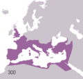
 Achaemenid Empire.gif 1,359 × 1,035; 405 KB
-
 AnimatieGraniteRomania 1859-2010.gif 1,000 × 861; 3.33 MB
-
 Australia history.gif 795 × 595; 208 KB
-
 Australia history2.gif 795 × 595; 447 KB
-
 Australia states evolution.gif 500 × 468; 38 KB
-
 Australian states history blank.gif 300 × 279; 42 KB
-
 Australian states history.gif 300 × 279; 82 KB
-
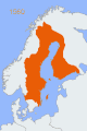
 Border changes in Finland.gif 175 × 247; 179 KB
-
 Brazil states.gif 370 × 330; 28 KB
-
 Byzantine Empire animated-ar.gif 800 × 370; 434 KB
-
 Byzantine Empire animated-zh.gif 800 × 370; 442 KB
-
 Byzantine Empire animated.gif 800 × 370; 490 KB
-
 Byzantine Empire map.gif 800 × 760; 66 KB
-
 Cambios territoriales de Colombia.gif 1,082 × 1,154; 488 KB
-
 Canada provinces evolution - ru.gif 1,000 × 864; 310 KB
-
 Canada provinces evolution 2.gif 1,000 × 864; 243 KB
-
 Canada provinces evolution-250.gif 250 × 216; 211 KB
-
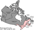
 Canada provinces evolution.gif 1,000 × 864; 247 KB
-
 China Dynasties.gif 956 × 676; 1.4 MB
-
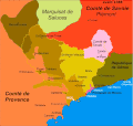 County of Nice animated.gif 1,136 × 1,080; 1.88 MB
-
 Der deutsche staat seit 1867.gif 1,052 × 673; 656 KB
-
 Evolucion territorial Arquidiocesis de Medellin.gif 1,272 × 1,166; 304 KB
-
 Evolucion Territorio Mexicano.gif 626 × 599; 1.28 MB
-
 Evolucion VLN.gif 404 × 340; 923 KB
-
 Evolución territorial de Colombia.gif 889 × 803; 905 KB
-
 Evolución territorial de México (1821-1981).gif 800 × 760; 466 KB
-
Evolution of United States standard time zone boundaries.webm 29 s, 3,507 × 2,480; 4.58 MB
-
 ExpansionOtomana.gif 276 × 176; 19 KB
-
 ExpansionOtomanaMejorado.gif 276 × 176; 5 KB
-
 Frontiere francaise 985 1947 small.gif 466 × 430; 1.19 MB
-
 Frontiere francaise 985 1947.gif 931 × 859; 2.02 MB
-
 Hundred years war.gif 541 × 621; 140 KB
-
 Maps of China 1912-Now.gif 412 × 293; 25 KB
-
 Mexico states evolution.gif 1,000 × 957; 331 KB
-
 Mohammad adil rais-Rashidun Caliphate-different phases.gif 1,400 × 675; 62 KB
-
 Mohammad adil-Rashidun empire-slide.gif 1,196 × 580; 84 KB
-
 Mongol Empire map 2.gif 752 × 591; 165 KB
-
 Mongol Empire map.gif 752 × 591; 162 KB
-
 Naher Osten historisch - Osmanisches Reich 1830-1923.gif 1,104 × 834; 128 KB
-
 Non-Native American Nations Control over South America 1700 and on.gif 800 × 1,100; 262 KB
-

-
 Ottoman small animation.gif 300 × 240; 10 KB
-
 OttomanEmpire1300-1923.svg 512 × 285; 165 KB
-
 Parthian Empire.gif 1,359 × 1,035; 309 KB
-
 Penang.gif 461 × 604; 18 KB
-
 Political Evolution of Central America and the Caribbean 1700 and on.gif 850 × 638; 348 KB
-
 Pre-Achaemenid Era.gif 1,359 × 1,035; 168 KB
-
 Quezon province territorial evolution.gif 382 × 678; 631 KB
-
 Rise and Fall of the Ottoman Empire 1300-1923int.gif 656 × 600; 179 KB
-
 RomaniaBorderHistoryAnnimation 1859-2010 es.gif 1,000 × 861; 142 KB
-
 RomaniaBorderHistoryAnnimation 1859-2010 tr.gif 1,000 × 861; 166 KB
-
 RomaniaBorderHistoryAnnimation 1859-2010.gif 1,000 × 861; 162 KB
-
 Sasanian Empire.gif 1,359 × 1,037; 619 KB
-
 Sweden2.gif 398 × 599; 66 KB
-
Territorial evolution of San Jose, California, 1850–2022 in OpenHistoricalMap.webm 17 s, 2,880 × 1,800; 1,015 KB
-
Territorial evolution of San Jose, California, 1950–1969 in OpenHistoricalMap.webm 23 s, 2,880 × 1,800; 1.74 MB
-
 Territorial evolution of the Eastern Roman Empire.gif 1,200 × 675; 1.36 MB
-
 Territorial-changes-of-Poland-1635-2009-improved.gif 550 × 400; 4.11 MB
-
 Territorial-changes-of-Poland-1635-2009-small.gif 380 × 313; 673 KB
-
 Territorial-changes-of-Poland-1635-2009.gif 750 × 618; 5.38 MB
-
 Territories of Dynasties in China.gif 556 × 537; 1.32 MB
-
 The german state since 1867.gif 1,052 × 673; 642 KB
-
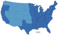 United States 1860-1870.gif 787 × 483; 49 KB
-
 USA Territorial Growth small.gif 431 × 287; 456 KB
-
 USA territorial growth.gif 921 × 573; 2.01 MB
-
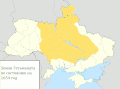 Территориальные изменения Украины.gif 1,400 × 1,035; 1.09 MB


.gif)


