Category:Welsh-language maps
Jump to navigation
Jump to search
Please place all maps in Welsh in this category.
Subcategories
This category has the following 2 subcategories, out of 2 total.
W
Media in category "Welsh-language maps"
The following 20 files are in this category, out of 20 total.
-
 2014 ebola virus epidemic in West Africa simplified cy.svg 1,600 × 850; 362 KB
-
 605 of 'Hanes y Brytaniaid a'r Cymry' (11099901425).jpg 2,316 × 2,981; 1.67 MB
-
 Annibyniaeth gwledydd 4.svg 2,389 × 1,189; 222 KB
-
 Australian states cy.jpg 1,200 × 1,084; 103 KB
-
Croeso i MapData Cymru.webm 2 min 29 s, 1,280 × 720; 8.05 MB
-
DataMapWales- Accessing Mapio Cymru.webm 1 min 1 s, 1,920 × 1,080; 3.64 MB
-
 Doggerland-cy.svg 545 × 600; 122 KB
-
 Geologic map Wales & SW England CY.svg 2,220 × 1,940; 1.74 MB
-
 Hecataeus world map-cy.svg 825 × 803; 67 KB
-
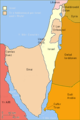
 Map Môr Hafren.svg 585 × 414; 51 KB
-
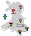 Map of Church in Wales cy.svg 761 × 867; 813 KB
-
 Map yn dangos lleoliadau 13 o ffynhonnau ar Ben y Gogarth, Llandudno.jpg 2,594 × 1,578; 493 KB
-
MapDataCymru- Mynediad at Mapio Cymru.webm 1 min 7 s, 1,920 × 1,080; 3.92 MB
-
 Mappa a'n Hyns Dagrow.png 2,025 × 1,547; 3.19 MB
-
 Northern icesheet cy.svg 2,236 × 1,640; 140 KB
-
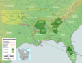
 PEATMAP Welsh version.jpg 1,920 × 975; 520 KB
-
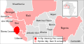
 Rhyfel chwe diwrnod map.png 398 × 599; 70 KB
-
 South east Cornish Rivers Kernoweg.gif 571 × 600; 62 KB
-

-
Welcome to DataMap Wales.webm 2 min 20 s, 1,280 × 720; 7.24 MB

.jpg)


.jpg)