Category:Maps of New Hampshire
Jump to navigation
Jump to search
States of the United States: Alabama · Alaska · Arizona · Arkansas · California · Colorado · Connecticut · Delaware · Florida · Georgia · Hawaii · Idaho · Illinois · Indiana · Iowa · Kansas · Kentucky · Louisiana · Maine · Maryland · Massachusetts · Michigan · Minnesota · Mississippi · Missouri · Montana · Nebraska · Nevada · New Hampshire · New Jersey · New Mexico · New York · North Carolina · North Dakota · Ohio · Oklahoma · Oregon · Pennsylvania · Rhode Island · South Carolina · South Dakota · Tennessee · Texas · Utah · Vermont · Virginia · Washington · West Virginia · Wisconsin · Wyoming – Washington, D.C.
insular area of the United States: American Samoa · Guam · Northern Mariana Islands · Puerto Rico · United States Virgin Islands – United States Minor Outlying Islands: Baker Island · Howland Island · Jarvis Island · Johnston Atoll · Kingman Reef · Midway Atoll · Navassa Island · Palmyra Atoll · Wake Island
insular area of the United States: American Samoa · Guam · Northern Mariana Islands · Puerto Rico · United States Virgin Islands – United States Minor Outlying Islands: Baker Island · Howland Island · Jarvis Island · Johnston Atoll · Kingman Reef · Midway Atoll · Navassa Island · Palmyra Atoll · Wake Island
Wikimedia category | |||||
| Upload media | |||||
| Instance of | |||||
|---|---|---|---|---|---|
| Category combines topics | |||||
| New Hampshire | |||||
state of the United States of America   .svg) | |||||
| Pronunciation audio | |||||
| Instance of | |||||
| Part of | |||||
| Named after | |||||
| Location |
| ||||
| Located in or next to body of water | |||||
| Capital | |||||
| Legislative body | |||||
| Executive body | |||||
| Highest judicial authority |
| ||||
| Official language | |||||
| Anthem |
| ||||
| Head of government |
| ||||
| Inception |
| ||||
| Highest point | |||||
| Population |
| ||||
| Area |
| ||||
| Elevation above sea level |
| ||||
| Replaces | |||||
| Different from | |||||
| Maximum temperature record |
| ||||
| Minimum temperature record |
| ||||
| official website | |||||
 | |||||

Subcategories
This category has the following 29 subcategories, out of 29 total.
Media in category "Maps of New Hampshire"
The following 48 files are in this category, out of 48 total.
-

-

-
-

-
-
-
-
 Area codes vt.png 400 × 465; 25 KB
-
 Ctrnh.jpg 1,275 × 1,650; 2.1 MB
-
 High Street, Whitefield, NH.jpg 550 × 350; 49 KB
-
 MA Norfolk (old) Co towns map.png 947 × 1,380; 386 KB
-
 Map of New Hampshire - NARA - 78117674 (page 1).jpg 14,857 × 9,472; 26.73 MB
-
 Map of New Hampshire - NARA - 78117674 (page 2).jpg 14,660 × 9,484; 29.4 MB
-
 Map of New Hampshire Regions.png 1,488 × 2,105; 310 KB
-
 Map of USA highlighting New Hampshire.png 280 × 183; 35 KB
-
 Merrimack Valley NH.png 677 × 1,277; 116 KB
-
 Narratives of the Indian wars, 1675-1699 (1913) (14782307884).jpg 2,928 × 2,268; 445 KB
-
 Nashua High School District Map.png 932 × 1,000; 15 KB
-
 New England Minor Civil Divisions.png 718 × 945; 325 KB
-
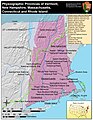
 New england ref 2001.jpg 900 × 1,361; 385 KB
-
 New England Town Lines and Borders in the Six New England States.png 1,180 × 1,500; 134 KB
-
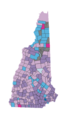
 New Hampshire Communities by per capita income.png 677 × 1,277; 142 KB
-
 New Hampshire Executive Council Districts.png 565 × 586; 90 KB
-
 New Hampshire House Results 2012 by Municipality.svg 810 × 810; 99 KB
-
 New Hampshire House Results 2014 by Municipality.svg 810 × 810; 99 KB
-
 New Hampshire House Results 2018 by Municipality.svg 810 × 810; 99 KB
-
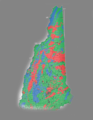
 New Hampshire Köppen.png 6,300 × 9,600; 394 KB
-
 New Hampshire municipalities.png 677 × 1,277; 108 KB
-
 New Hampshire population map.png 600 × 600; 118 KB
-
 New Hampshire Presidential Election Results 1844.png 497 × 749; 29 KB
-
 New Hampshire Shaded Relief 5.jpg 224 × 389; 34 KB
-
 New Hampshire wind resource map 50m 800.jpg 850 × 1,100; 493 KB
-
 NH - State Police Troops.png 324 × 600; 88 KB
-
 NH ancestry.png 394 × 684; 19 KB
-
 Nh communities by population.png 720 × 1,207; 249 KB
-
 Nh covered bridge map display 1967.jpg 2,028 × 3,000; 2.62 MB
-
 NHmap-bedford-2.gif 228 × 408; 8 KB
-
 NHMap-doton.png 150 × 286; 11 KB
-
 NOAA Weather Radio WNG575 Coverage Map.png 725 × 996; 104 KB
-
 Panoramic Map Detail, Farmington, NH.jpg 316 × 349; 41 KB
-
-
 Population density of New Hampshire counties (2020).png 2,537 × 4,130; 568 KB
-
 Radonnhmap.png 2,550 × 3,300; 2.99 MB
-
 Rand McNally Map of New Hampshire.jpg 2,664 × 3,612; 2.58 MB
-
 Relief map of New Hampshire.jpg 275 × 390; 33 KB
-
 SalisburyNHLoc.PNG 480 × 869; 18 KB
-
 State of New Hampshire with Counties & Towns.png 4,500 × 7,000; 6.45 MB
-
 WebsterNHLoc.PNG 480 × 869; 18 KB


_(14577151507).jpg)


_Co_towns_map.png)
.jpg)
.jpg)


_(14782307884).jpg)


.jpg)
.png)


