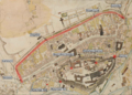
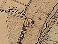
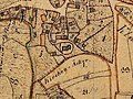
Category:Maps by Royal Bavarian Land Tax Commission
Jump to navigation
Jump to search
English: Maps created for Royal Bavarian Land Survey.
Deutsch: Ortsblätter (Flurkarten der Uraufnahme, Maßstab 1:5000 bis 1:1000) der Steuer-Kataster-Kommission im Königreich Bayern.
Subcategories
This category has only the following subcategory.
O
- Ortsblätter des Königreich Bayerns (2460 F)
Media in category "Maps by Royal Bavarian Land Tax Commission"
The following 159 files are in this category, out of 159 total.
-
 Adelschlag 1813 A6 a.jpg 1,312 × 969; 378 KB
-
 Adelschlag 1813 A6.jpg 2,500 × 2,503; 399 KB
-
 Aubing1809.jpg 1,986 × 2,351; 595 KB
-
 Aubing1809small.jpg 1,146 × 1,837; 318 KB
-
 Aubing1873.jpg 2,172 × 2,348; 1.08 MB
-
 Aubing1873small.jpg 1,043 × 2,109; 656 KB
-
 Augsburg - Rathaus, Ludwigsplatz - 19. Jahrhundert.tif 762 × 574; 1.1 MB
-
 Ausschnitt Stadtplan Pfaffenhofen Ilm 1810.jpg 800 × 355; 133 KB
-
 Bayreuth Juedischer Friedhof Uraufnahme Bayern.jpg 1,080 × 720; 707 KB
-
 Bild Zieglhäuser 1836 01.JPG 1,488 × 1,208; 196 KB
-
 Bild Zieglhäuser 1836 02.JPG 2,000 × 3,008; 496 KB
-
 Buch (Kipfenberg) 1836 B100.jpg 2,500 × 2,588; 276 KB
-
 Burg Angerberg 001.jpg 4,928 × 2,536; 6.92 MB
-
 Burg Dobl 001.jpg 4,910 × 2,544; 4.47 MB
-
 Burg Rainding 001.jpg 4,928 × 2,516; 5.23 MB
-
 Burg Rothenstein (Bad Grönenbach) Historischer Kartenausschnitt.jpg 612 × 470; 326 KB
-
 Burghausen Flurkarte, In den Grüben.jpg 846 × 754; 370 KB
-
 Burgstall Bergheide 001.jpg 4,924 × 2,508; 5.95 MB
-
 Burgstall Neuhaus (Hauzenberg) 001.jpg 4,876 × 2,530; 6.65 MB
-
 Burgstall Windischeschenbach 001.jpg 4,900 × 2,516; 6.25 MB
-
 Dippach 1847.jpg 1,024 × 768; 502 KB
-
 Eichendorf-Ort Eic 1826 E37.jpg 2,500 × 2,546; 1.94 MB
-
 Erlangen Essenbach Katasterplan 1822 001.JPG 1,000 × 716; 244 KB
-
 Erlangen Katasterplan 1821 001.JPG 2,495 × 2,471; 1.01 MB
-
 Erlangen Katasterplan 1821 002.JPG 2,487 × 2,462; 1.37 MB
-
 Erlangen Katasterplan 1821 003.JPG 2,464 × 2,448; 506 KB
-
 Erlangen Katasterplan 1821 004.JPG 2,555 × 4,043; 2.57 MB
-
 Erlangen-Eltersdorf Urkatasterplan 1826-29 001.png 745 × 1,000; 1.28 MB
-
 Eschenlohe 1810 E77 a.jpg 1,691 × 1,281; 1,003 KB
-
 Eschenlohe 1810 E77.jpg 2,500 × 2,451; 483 KB
-
 Fall geflutet und neu erbaut.png 1,640 × 1,595; 5.91 MB
-
 Flurgrenzen.PNG 1,870 × 931; 3.6 MB
-
 Flurkarte Mühldorf 1814.jpg 939 × 935; 295 KB
-
 Flurkarte Oberpreuschwitz (1850).png 935 × 639; 186 KB
-
 Garmisch 1815 G8 a.jpg 1,678 × 1,674; 1.66 MB
-
 Garmisch 1815 G8.jpg 2,500 × 2,550; 744 KB
-
 Garmisch 1861 G8-1-2 a.jpg 2,296 × 2,320; 1.92 MB
-
 Garmisch 1861 G8-1-2.jpg 2,500 × 2,524; 1.08 MB
-
 Großmehring 1813 G93 a.jpg 2,174 × 1,029; 353 KB
-
 Großmehring 1813 G93.jpg 2,500 × 2,493; 478 KB
-
 Gunzendorf.PNG 527 × 303; 393 KB
-
 Hauptmarkt Nürnberg 1811.jpg 345 × 430; 172 KB
-
 Heinersreuth.PNG 462 × 370; 459 KB
-
 Historische Karte Großziegenfeld.jpg 578 × 580; 111 KB
-
 Historische Karte Kleinziegenfeld.jpg 1,042 × 1,404; 365 KB
-

-
 Historische Karte von Modschiedel (1851).jpg 735 × 830; 164 KB
-
 Hofstetten 1811 H87.jpg 2,500 × 2,544; 453 KB
-
 Hofstetten bei Hitzhofen 1813 H86 a.jpg 1,001 × 921; 367 KB
-
 Hofstetten bei Hitzhofen 1813 H86.jpg 2,500 × 2,533; 396 KB
-
 Holzeralm Gmund Historische Flurkarte.jpg 1,426 × 890; 1.32 MB
-
 Holzeralm Gmund Historische Flurkarte.png 1,426 × 890; 3.36 MB
-
 Hopferstadt (Urkatasterplan um 1825).png 2,336 × 2,424; 1.01 MB
-
 Iphofen Urkataster.png 448 × 474; 583 KB
-
 Karte Freising 1809.jpg 2,431 × 2,417; 968 KB
-
 Karte Freising Neustift 1810.jpg 2,465 × 2,441; 3.25 MB
-
 Karte Freising Nordosten 1809.jpg 2,480 × 2,448; 1.63 MB
-
 Karte Freising Süden&Domberg 1809.jpg 2,471 × 2,426; 4.13 MB
-
 Karte Freising Vötting ca 1810.jpg 2,440 × 2,396; 2.98 MB
-
 Karte Freising Westen 1809.jpg 2,459 × 2,449; 4.73 MB
-
 Karte Groß+Kleinziegenfeld.jpg 2,427 × 2,429; 888 KB
-
 Kasberg-map-1822-greyscales-detail-village.jpg 942 × 820; 217 KB
-
 Kasberg-map-1822-greyscales.jpg 2,410 × 1,978; 1.03 MB
-
 Kataster Burghalde Kempten 1823.png 1,025 × 575; 1.5 MB
-
 Kempten Reichsstadt-Fürststift 1823.jpg 1,183 × 645; 526 KB
-
 Kipfenberg 1814 K28 a.jpg 1,074 × 1,283; 539 KB
-
 Kipfenberg 1814 K28.jpg 2,500 × 2,536; 464 KB
-
 Lagekarte Biebermühle Weismain.jpg 174 × 116; 30 KB
-
 Lagekarte Hammerschmiede Kleinziegenfeld.jpg 995 × 663; 236 KB
-
 Lagekarte Rohrmühle Altenkunstadt.jpg 290 × 435; 173 KB
-
 Lenting 1813 L39 a.jpg 1,247 × 1,142; 419 KB
-
 Lenting 1813 L39.jpg 2,500 × 2,504; 352 KB
-
 Lindau-St Lin 1822 l11.jpg 2,500 × 2,440; 2.71 MB
-
 Map Farchant 1861 small-1.jpg 755 × 880; 904 KB
-
 Map Farchant 1861.jpg 2,345 × 2,382; 1.26 MB
-
 Mittenwald 1815 M60 a.jpg 2,200 × 1,457; 1.53 MB
-
 Mittenwald 1815 M60.jpg 2,500 × 2,513; 672 KB
-
 Mittenwald 1860 M60-1-2 a.jpg 2,296 × 2,422; 2.82 MB
-
 Mittenwald 1860 M60-1-2.jpg 2,500 × 2,573; 1,000 KB
-
 Mittenwald Ortsblatt 1860.jpg 2,036 × 2,184; 3.97 MB
-
 Münchaurach Karte 1828.jpg 745 × 761; 246 KB
-
 Wöhrd Katasterplan 1811 001.JPG 2,430 × 2,415; 1.38 MB
-
 Nürnberg Katasterplan 1811 001.JPG 2,373 × 2,397; 975 KB
-
 Nürnberg Katasterplan 1811 002.JPG 4,350 × 4,036; 4.22 MB
-
 Nürnberg Katasterplan 1811 003.JPG 2,388 × 2,398; 1.28 MB
-
 Nürnberg Katasterplan 1811 004.JPG 2,407 × 2,400; 1.11 MB
-
 Nürnberg Katasterplan 1811 005.JPG 2,396 × 2,387; 763 KB
-
 Nürnberg Katasterplan 1811 006.JPG 2,395 × 2,401; 802 KB
-
 Nürnberg Katasterplan 1811 007.JPG 2,380 × 2,411; 1.02 MB
-
 Nürnberg Katasterplan 1811 008.JPG 2,407 × 2,333; 1.1 MB
-
 Nürnberg Katasterplan Bärenschanze 1811 001.JPG 682 × 643; 119 KB
-
 Nürnberg Katasterplan Deutschherrnbleiche 1811 001.JPG 727 × 493; 100 KB
-
 Nürnberg Katasterplan Gostenhof 1811 001.JPG 1,809 × 1,258; 648 KB
-
 Nürnberg Katasterplan Kleinweidenmühle 1811 001.JPG 1,484 × 1,353; 576 KB
-
 Ohlstadt 1810 O72 a.jpg 1,384 × 1,904; 1.08 MB
-
 Ohlstadt 1810 O72.jpg 2,500 × 2,600; 467 KB
-
 Ohlstadt 1859 O72-1-2 a.jpg 1,732 × 2,186; 2.23 MB
-
 Ohlstadt 1859 O72-1-2.jpg 2,500 × 2,404; 916 KB
-
 Orstblatt Brückenau-1848.jpg 1,357 × 1,500; 531 KB
-
 Ort For 1809 F29.jpg 2,500 × 2,549; 535 KB
-
 Ort Kag 1831 K1.jpg 2,396 × 2,401; 822 KB
-
 Ortsblatt Brückenau-1848-Ausschnitt.jpg 1,013 × 1,151; 397 KB
-
 Ortsblatt Kager.jpg 450 × 300; 44 KB
-
 Ortsblatt Puch, 1861, Ausschnitt.jpg 451 × 397; 106 KB
-
 Ortsblatt Puch-1861-Ausschnitt.jpg 2,500 × 2,513; 747 KB
-
 Ortskarte Oberammergau 1816 detail.jpg 1,175 × 817; 1,004 KB
-
 Ortskarte Oberammergau 1816.jpg 2,356 × 2,415; 3.23 MB
-
 Ortskarte Oberammergau 1862.jpg 2,426 × 2,385; 3.78 MB
-
 Ortsplan Altenkunstadt & Theisau (1851).jpg 2,416 × 2,427; 1.3 MB
-
 Ortsplan Altenkunstadt (1851).jpg 1,680 × 1,356; 675 KB
-
 Ortsplan Burgkunstadt (1851).jpg 1,856 × 1,652; 730 KB
-
 Ortsplan Ebneth (1851).jpg 828 × 1,168; 356 KB
-
 Ortsplan Gärtenroth (1851).jpg 1,005 × 1,389; 608 KB
-
 Ortsplan Mainroth (1851).jpg 1,361 × 1,088; 498 KB
-
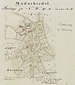
 Ortsplan Modschiedel, Weiden, Wohnsig, Wunkendorf (1851).jpg 2,422 × 2,429; 1.33 MB
-
 Ortsplan Strössendorf (1851).jpg 903 × 1,053; 432 KB
-
 Ortsplan Theisau (1851).jpg 534 × 1,069; 265 KB
-
 Ortsplan von Weiden (1851).jpg 750 × 977; 242 KB
-
 Ortsplan von Wohnsig (1851).jpg 764 × 670; 184 KB
-
 Ortsplan von Wunkendorf (1851).jpg 822 × 715; 220 KB
-
 Ortsplan Weidnitz & Strössendorf (1851).jpg 2,407 × 2,411; 1.55 MB
-
 Ortsplan Weidnitz (1851).jpg 1,176 × 1,296; 504 KB
-
 Partenkirchen 1814 P6 a.jpg 1,810 × 1,742; 1.19 MB
-
 Partenkirchen 1814 P6.jpg 2,500 × 2,545; 560 KB
-
 Partenkirchen 1861 P6-1-2 a.jpg 2,246 × 2,263; 8.56 MB
-
 Partenkirchen 1861 P6-1-2.jpg 2,500 × 2,506; 962 KB
-
 Passau-St Pas 1827-MJ.jpg 4,358 × 2,297; 8.83 MB
-
 Plan der Stadt Kempten 1823.jpg 2,432 × 2,412; 2.79 MB
-
 Schloss Fischach Lageskizze.png 841 × 569; 1.11 MB
-
 Schwabing-St Muen 1853 15.jpg 3,635 × 3,065; 17.35 MB
-
 Schweinau Steinbühl Katasterplan 1811 001.JPG 2,341 × 2,343; 639 KB
-
 St Pas 1827 p2.jpg 2,500 × 2,503; 2.33 MB
-
 St Vil 1826 v4.jpg 2,500 × 2,461; 1.2 MB
-
 Stadt Eichstätt 1814 e4-1-2.jpg 2,500 × 2,535; 1.38 MB
-
 Stadt Eichstätt 1814 e4-1-3.jpg 2,500 × 2,454; 1.18 MB
-
 Stadt Eichstätt 1814 e4-1-4.jpg 2,500 × 2,430; 627 KB
-
 Stadt Eichstätt 1814 e4.jpg 2,500 × 2,448; 1.51 MB
-
 Stadt Eichstätt Stadtplan 1814.jpg 4,007 × 4,008; 4.64 MB
-
 Stadt Ingolstadt 1816 i2-1-2.jpg 2,500 × 2,624; 1,009 KB
-
 Stadt Ingolstadt 1816 i2.jpg 2,500 × 2,499; 964 KB
-
 Stadtbefestigung Freising.png 1,665 × 1,189; 3.75 MB
-
 Sulzbuerg2.jpg 483 × 413; 230 KB
-
 Teisbach Ortsplan 1812.jpg 2,065 × 1,388; 2.22 MB
-
 Teißing 1813 T10 a.jpg 954 × 1,053; 312 KB
-
 Teißing 1813 T10.jpg 2,500 × 2,517; 336 KB
-
 Traubing 1810 T42 a.jpg 1,055 × 1,541; 616 KB
-
 Traubing 1810 T42.jpg 2,500 × 2,513; 356 KB
-
 Traubing 1863 T42-1-2 a.jpg 1,056 × 1,347; 825 KB
-
 Traubing 1863 T42-1-2.jpg 2,500 × 2,523; 498 KB
-
 Turmhügel Lughof 001.jpg 4,912 × 2,510; 5.03 MB
-
 Turmhügel Obermelsendorf 01.jpg 4,924 × 2,550; 7.03 MB
-
 Turmhügel Schlosshügel (Seehöflein) 01.jpg 4,078 × 2,560; 4.84 MB
-
 Turmhügel Seeleiten 01.jpg 4,900 × 2,566; 6.35 MB
-
 Turmhügel Wölkendorf 01.jpg 2,190 × 2,398; 2.33 MB
-
 Uraufnahme Itzlishofen.jpg 656 × 492; 95 KB
-
 Uraufnahme Siegertshofen.jpg 672 × 504; 109 KB
-
 Uraufnahme St. Michael Fischach.jpg 490 × 368; 61 KB
-
 Uraufnahme Synagoge Fischach.jpg 520 × 390; 68 KB
-
 Weisbrunn 1847.jpg 1,024 × 768; 566 KB


_1836_B100.jpg)


_Historischer_Kartenausschnitt.jpg)


_001.jpg)


.png)


_Uraufnahme,_entstanden_zwischen_1808-1864.jpg)
.jpg)


.png)


.jpg)
.jpg)
.jpg)
.jpg)
.jpg)
.jpg)
.jpg)
.jpg)
.jpg)
.jpg)
.jpg)
.jpg)
.jpg)
.jpg)


_01.jpg)


