Category:Isochrone maps
Jump to navigation
Jump to search
map showing areas related to isochrones between different points | |||||
| Upload media | |||||
| Subclass of |
| ||||
|---|---|---|---|---|---|
| |||||
Media in category "Isochrone maps"
The following 11 files are in this category, out of 11 total.
-
 Austro-hungarian-empire-railway-network-1912-2-2.png 1,972 × 1,467; 989 KB
-
 Chariot spread.png 400 × 231; 154 KB
-
 Drive time isochrones airports northern Finland.png 3,507 × 2,480; 4.35 MB
-
 Iso4app Screenshot (Widget for Isochrones and Isodistaces).jpg 764 × 464; 97 KB
-
 Isochrone Brandenburger Tor openrouteservice.png 878 × 727; 685 KB
-
 Isochronic Passage Chart Francis Galton 1881.jpg 1,145 × 749; 335 KB
-
 Map of Melbourne and environs electric railway time zones.jpg 7,000 × 6,415; 13.87 MB
-
 Map of Melbourne and environs minimum railway or tramway time zones.jpg 7,000 × 6,422; 12.15 MB
-
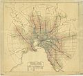
 Map of Melbourne and suburbs showing time zones-present railways & tramways.jpg 7,000 × 6,395; 11.14 MB
-
 Metrominuto isochrone centre culturel cabestany.svg 3,130 × 3,090; 1.89 MB
-
 Portlandmaine povmap (Converted).jpg 676 × 823; 76 KB


.jpg)


.jpg)