Category:Archaeological maps
Jump to navigation
Jump to search

map and inventory of finding archaeological sites | |||||
| Upload media | |||||
| Instance of | |||||
|---|---|---|---|---|---|
| Subclass of | |||||
| Depicts | archaeological site | ||||
| |||||
Subcategories
This category has the following 7 subcategories, out of 7 total.
Media in category "Archaeological maps"
The following 48 files are in this category, out of 48 total.
-
 America 1000 BCE-ar.png 1,407 × 2,138; 171 KB
-
 America 1000 BCE.png 1,407 × 2,138; 135 KB
-
 Antica città di Miriandro mappa.jpg 924 × 442; 92 KB
-
 ArchaeoGLOBE EXAG.gif 1,800 × 1,200; 6.84 MB
-
 ArchaeoGLOBE FHG.gif 1,000 × 666; 2.55 MB
-
 ArchaeoGLOBE INAG.gif 1,800 × 1,200; 5.86 MB
-
 ArchaeoGLOBE PAS.gif 1,000 × 666; 2.64 MB
-
 ArchaeoGLOBE URBAN.gif 1,000 × 666; 1.6 MB
-
 Archaeological map of Caddington and Dunstable district. Wellcome M0015598.jpg 3,750 × 2,929; 4.58 MB
-
 Archaeological map of human settlements in the Chavusy Raion.svg 2,373 × 2,145; 395 KB
-
 Arheološka mapa Vrbasa.tif 3,977 × 2,465; 9.68 MB
-
 Begazy-Dandybai Complex.png 862 × 555; 663 KB
-
 Biface Extension.png 1,244 × 895; 108 KB
-
 Camp de légion de Deva Victrix.png 10,954 × 10,431; 3.54 MB
-
 Carte 3.jpg 1,112 × 898; 230 KB
-
 Carte hachereaux.jpg 1,535 × 1,063; 448 KB
-
 Carte site Archéologique d'Allonnes 2.jpg 278 × 224; 21 KB
-
 Carte site Archéologique d'Allonnes 3.jpg 139 × 112; 6 KB
-
 Carte site Archéologique d'Allonnes 4.jpg 139 × 112; 6 KB
-
 Carte site Archéologique d'Allonnes 5.jpg 139 × 112; 6 KB
-
 Carte site Archéologique d'Allonnes 6.jpg 556 × 449; 57 KB
-
 Chaff faced ware culture map.jpg 1,607 × 1,080; 161 KB
-
 Chariot spread.png 400 × 231; 154 KB
-
 Cro-Magnon range 30,000 ybp.svg 147 × 130; 286 KB
-
 Drovener heide.gif 329 × 434; 9 KB
-
 Epifania di Cilicia.jpg 924 × 442; 93 KB
-
 Expansión de la cultura Tiahuanaco.jpg 400 × 400; 45 KB
-
 Homo Sapiens Dispersal Routes.jpg 1,000 × 519; 63 KB
-
 Kintampo Complex.png 500 × 340; 39 KB
-
 Map from the Ninevah expedition by Sir Henry Layards Wellcome M0004421.jpg 2,986 × 3,735; 1.34 MB
-
 Map of Assyria from the Ninevah expedition by Sir Layards Wellcome M0004422.jpg 2,928 × 3,774; 1.39 MB
-
 Map of Kashmir, Kalhana's Rajatarangini, A Chronicle of the Kings of Kashmir, Marc Aural Stein.jpg 11,910 × 8,184; 13.28 MB
-
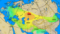
 Map of Trialetian.png 943 × 663; 237 KB
-
 Neolithic Expansion.gif 741 × 363; 16 KB
-
 Osoid culture.svg 654 × 479; 750 KB
-
 Quarterly Journal of the Geological Society of London, vol. 33 no. 32 fig. 9.png 2,532 × 2,008; 2.73 MB
-
 ROCEEH Motm-2011 01 Early Pleistocene presence of Homo in Eurasia.pdf 1,754 × 1,239; 456 KB
-

-
 SITAR2015.jpg 1,920 × 1,088; 1.21 MB
-
 Site du Roc'h à Arzano (29).jpg 800 × 600; 86 KB
-
 Sketch of London where amulet necklaces were found Wellcome L0051628.jpg 6,666 × 4,992; 5.73 MB
-
 Sketch Plan of Jiaohe(Yarkhoto) City.png 2,106 × 790; 351 KB
-
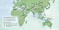
 Spreading homo sapiens la.svg 1,692 × 791; 766 KB
-
 Spreading homo sapiens ru.svg 851 × 400; 737 KB
-
 Spreading homo sapiens.jpg 3,800 × 2,234; 415 KB
-
 Stara lysa archaeological sites.png 828 × 1,000; 211 KB
-
 Three Hares Symbol - Map.svg 1,000 × 500; 549 KB
-
 Археологическая карта Кубанской области (1882).jpg 4,748 × 3,897; 9.91 MB


.jpg)


.jpg)
_City.png)