Category:OpenStreetMap maps of the Netherlands
Jump to navigation
Jump to search
Countries of Europe: Albania · Andorra · Armenia‡ · Austria · Azerbaijan‡ · Belarus · Belgium · Bosnia and Herzegovina · Bulgaria · Croatia · Cyprus‡ · Czech Republic · Denmark · Estonia · Finland · France‡ · Georgia‡ · Germany · Greece · Hungary · Iceland · Republic of Ireland · Italy · Kazakhstan‡ · Latvia · Liechtenstein · Lithuania · Luxembourg · Malta · Moldova · Montenegro · Netherlands‡ · North Macedonia · Norway · Poland · Portugal‡ · Romania · Russia‡ · San Marino · Serbia · Slovakia · Slovenia · Spain‡ · Sweden · Switzerland · Turkey‡ · Ukraine · United Kingdom · Vatican City
Specific status: Bailiwick of Guernsey · Isle of Man · Jersey – Limited recognition: Kosovo
‡: partly located in Europe
Specific status: Bailiwick of Guernsey · Isle of Man · Jersey – Limited recognition: Kosovo
‡: partly located in Europe

Subcategories
This category has the following 14 subcategories, out of 14 total.
Media in category "OpenStreetMap maps of the Netherlands"
The following 34 files are in this category, out of 34 total.
-
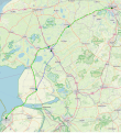
 A6 osm.png 1,058 × 908; 1,016 KB
-
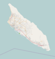
 Aruba2021OSM.png 5,555 × 5,555; 8.92 MB
-
 Belgium-Netherlands border changed.png 4,053 × 1,779; 5.07 MB
-
 Donge met Leij.png 2,380 × 3,956; 4.72 MB
-
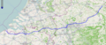 E34 map.png 1,115 × 472; 952 KB
-
 Georeferencing screenshot.jpg 1,241 × 360; 167 KB
-
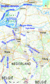
 Lek Location osm.png 1,471 × 544; 274 KB
-
 Lelylijn hypothetisch tracé.svg 908 × 992; 2.25 MB
-
 Lelylijn hypothetische tracés Potentieonderzoek 2020.svg 908 × 992; 2.28 MB
-
 Location map Aruba.png 913 × 966; 146 KB
-
 Location map Bonaire.png 739 × 780; 140 KB
-
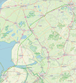
 Nederland-10-10-10.png 885 × 975; 846 KB
-
 Netherlands green power production (OpenStreetMap).jpg 1,695 × 1,871; 700 KB
-
 OSM Curacao.png 2,286 × 1,723; 224 KB
-
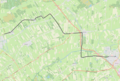
 Randstadspoor osma.png 1,249 × 1,108; 2.37 MB
-
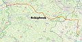 Schipbeek map.jpg 1,432 × 736; 641 KB
-
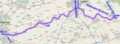
 Tramlijn Berlikum - Sint Annaparochie.png 1,371 × 1,007; 681 KB
-
 Tramlijn Bolsward - Harlingen.png 1,622 × 1,077; 1.39 MB
-
 Tramlijn Dokkum - Veenwouden.png 1,482 × 1,053; 1.44 MB
-
 Tramlijn Franeker - Arum.png 1,452 × 1,068; 1.15 MB
-
 Tramlijn Franeker - Marssum.png 1,519 × 1,090; 1.28 MB
-
 Tramlijn Harkezijl - Makkum.png 1,398 × 991; 680 KB
-
 Tramlijn Heerenveen - Drachten.png 1,507 × 1,020; 1.95 MB
-
 Tramlijn Heerenveen - Joure.png 1,495 × 1,086; 1.64 MB
-
 Tramlijn Joure - Sneek.png 1,550 × 1,078; 1.45 MB
-
 Tramlijn Leeuwarden - Sint Jacobiparochie.png 1,599 × 1,115; 1.46 MB
-
 Tramlijn Lippenhuizen - Oosterwolde.png 1,564 × 1,053; 1.57 MB
-
 Tramlijn Makkinga - Steenwijk.png 1,504 × 1,040; 2.47 MB
-
 Tramlijn Oosterwolde - Assen.png 1,563 × 1,055; 1.91 MB
-
 Tramlijn Sneek - Bolsward.png 1,421 × 1,006; 1.19 MB
-
 Tramlijn Tiel - Culemborg.png 1,473 × 1,047; 1.83 MB
-
 Tramlijn Veenwouden - Drachten.png 1,543 × 1,096; 2.17 MB
-
 Waddenzee Noord-Holland Friesland Groningen OSM.png 1,640 × 833; 1.67 MB
-
 Zeefanalyse 0.png 793 × 688; 433 KB


.jpg)


