File:View over Forsahavet of Efjorden towards south, Narvik, Nordland, Norway, 2023 September.jpg
Jump to navigation
Jump to search

Size of this preview: 800 × 356 pixels. Other resolutions: 320 × 142 pixels | 640 × 285 pixels | 1,024 × 456 pixels | 1,280 × 569 pixels | 2,560 × 1,139 pixels | 8,070 × 3,590 pixels.
Original file (8,070 × 3,590 pixels, file size: 18.73 MB, MIME type: image/jpeg)
Captions
Captions
Add a one-line explanation of what this file represents
Summary
[edit]
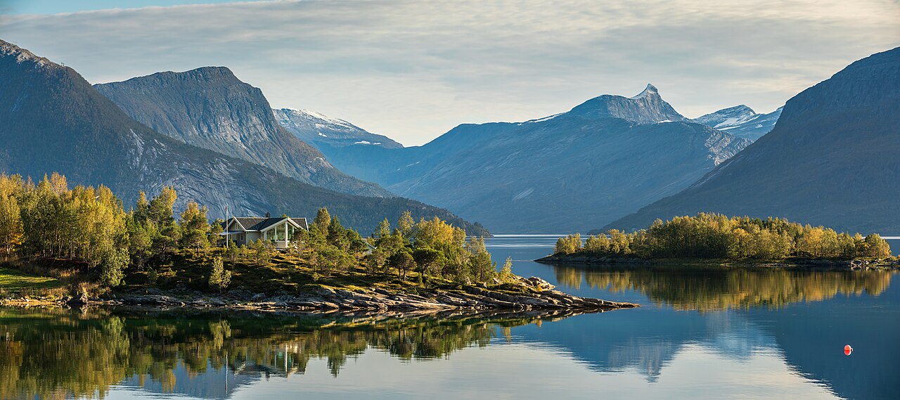
| Description | A view over Forsahavet of Efjorden towards south in Narvik, Nordland, Norway in 2023 September. The island ahead on the right is Vårsetholmen. Further ahead are mountains such as Karikollen and Kopptinden. |
| Date | |
| Source | Own work |
| Author | Ximonic (Simo Räsänen) |
| Camera location | | View this and other nearby images on: OpenStreetMap |
|---|
This file was uploaded with VicuñaUploader.
This image has been assessed using the Quality image guidelines and is considered a Quality image.
|
Licensing
[edit]
This file is licensed under the Creative Commons Attribution-Share Alike 4.0 International license.
Attribution: Simo Räsänen
- You are free:
- to share – to copy, distribute and transmit the work
- to remix – to adapt the work
- Under the following conditions:
- attribution – You must give appropriate credit, provide a link to the license, and indicate if changes were made. You may do so in any reasonable manner, but not in any way that suggests the licensor endorses you or your use.
- share alike – If you remix, transform, or build upon the material, you must distribute your contributions under the same or compatible license as the original.
| Annotations | This image is annotated: View the annotations at Commons |
File history
Click on a date/time to view the file as it appeared at that time.
| Date/Time | Thumbnail | Dimensions | User | Comment | |
|---|---|---|---|---|---|
| current | 16:41, 17 October 2023 | | 8,070 × 3,590 (18.73 MB) | Ximonic (talk | contribs) | VicuñaUploader 1.3.3a |
You cannot overwrite this file.
File usage on Commons
The following 4 pages use this file: