File:Rs map02.png
Jump to navigation
Jump to search
Size of this preview: 561 × 599 pixels. Other resolutions: 225 × 240 pixels | 449 × 480 pixels | 977 × 1,044 pixels.
Original file (977 × 1,044 pixels, file size: 51 KB, MIME type: image/png)
Captions
Captions
Add a one-line explanation of what this file represents
Summary
[edit]
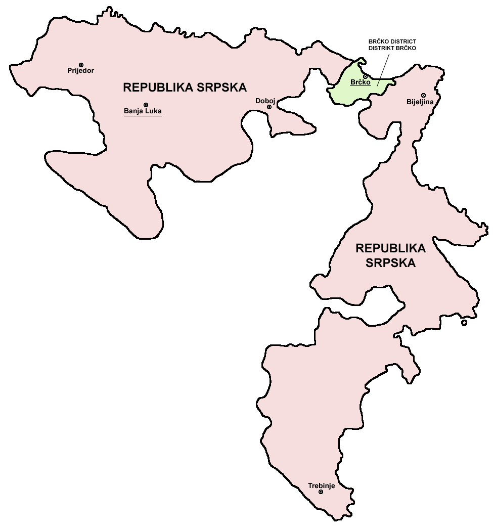
- English: Map of the Republika Srpska (Serb Republic) and Brčko District.
- Serbian: Mapa Republike Srpske i Distrikta Brčko.
Source and licence
[edit]

|
This map has been uploaded by Electionworld from en.wikipedia.org to enable the |
self made map by user:PANONIAN
| I, the copyright holder of this work, release this work into the public domain. This applies worldwide. In some countries this may not be legally possible; if so: I grant anyone the right to use this work for any purpose, without any conditions, unless such conditions are required by law. |
References
[edit]
- Slobodan Radovanović, Geografski atlas, Magic Map, Smederevska Palanka, 2001.
- Geografski atlas, Intersistem kartografija, Beograd, 2004.
- http://www.ohr.int/ohr-offices/brcko/images/map-brcko-district.jpg
- http://world-gazetteer.com/ archive copy at the Wayback Machine
File history
Click on a date/time to view the file as it appeared at that time.
| Date/Time | Thumbnail | Dimensions | User | Comment | |
|---|---|---|---|---|---|
| current | 08:56, 5 August 2011 | | 977 × 1,044 (51 KB) | PANONIAN (talk | contribs) | improved version |
| 08:41, 5 August 2011 |  | 610 × 602 (11 KB) | PANONIAN (talk | contribs) | Reverted to version as of 10:03, 16 July 2007 - please do not upload your work over mine. upload your map under separate filename | |
| 00:24, 11 April 2011 |  | 610 × 655 (92 KB) | Kacnepcku-Cp6uja (talk | contribs) | better quality | |
| 10:03, 16 July 2007 |  | 610 × 602 (11 KB) | Nihad Hamzic (talk | contribs) | The original image seems to had been saved as JPEG, and the previous uploader had simply directly converted it to PNG. I have greatly optimised image size by removing JPEG artifacts, reducing color domain etc. | |
| 15:48, 28 December 2006 |  | 610 × 602 (143 KB) | Electionworld (talk | contribs) | {{ew|en|PANONIAN}} {{link|Republika Srpska}} map (self made) {{PD-self}} Note: The borders of Republika Srpska were not determined on the basis of the natural geographical features of the region. Rather, the Inter-Entity Boundary Line runs essentially al |
You cannot overwrite this file.
File usage on Commons
The following 2 pages use this file:
File usage on other wikis
The following other wikis use this file:
- Usage on ast.wikipedia.org
- Usage on gl.wikipedia.org
- Usage on ie.wikipedia.org
- Usage on ja.wikipedia.org
- Usage on ka.wikipedia.org
- Usage on la.wikipedia.org
- Usage on lv.wikipedia.org
- Usage on oc.wikipedia.org
- Usage on ro.wikipedia.org
- Usage on szl.wikipedia.org
- Usage on ur.wikipedia.org
- Usage on xmf.wikipedia.org