File:Největší rozmach české moci na rozhraní století XIII. a XIV.jpg
Original file (1,472 × 1,467 pixels, file size: 534 KB, MIME type: image/jpeg)
Captions
Captions
Summary[edit]
| Description |
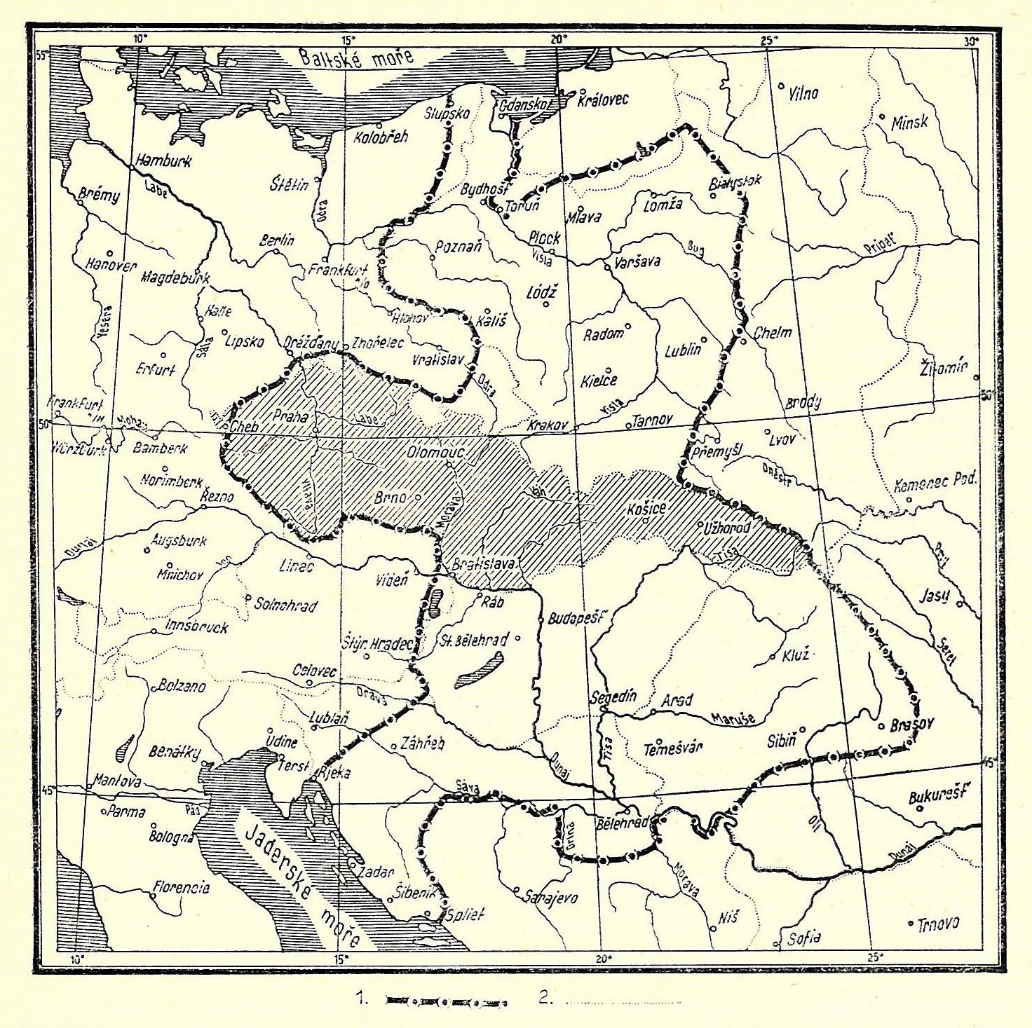
Čeština: Mapa největšího rozmachu moci českých králů na rozhraní 13. a 14. století. (1. hranice říše Přemyslovců, 2. hranice států v době vydání knihy.)
English: Map showing the largest territorial extension of the power of the Bohemian kings at the turn of the 14th century. (1. borders of the empire of the Přemyslids, 2. existing borders of states in 1937.) |
| Date | |
| Source | František Kurfürst: Válečné dějiny československé, Šolc a Šimáček, Praha, 1937 |
| Author | Unknown author |
Licensing[edit]
|
This is a faithful photographic reproduction of a two-dimensional, public domain work of art. The work of art itself is in the public domain for the following reason:
The official position taken by the Wikimedia Foundation is that "faithful reproductions of two-dimensional public domain works of art are public domain". This photographic reproduction is therefore also considered to be in the public domain in the United States. In other jurisdictions, re-use of this content may be restricted; see Reuse of PD-Art photographs for details. {{PD-Art}} template without license parameter: please specify why the underlying work is public domain in both the source country and the United States
(Usage: {{PD-Art|1=|deathyear=''year of author's death''|country=''source country''}}, where parameter 1= can be PD-old-auto, PD-old-auto-expired, PD-old-auto-1996, PD-old-100 or similar. See Commons:Multi-license copyright tags for more information.) | ||||
File history
Click on a date/time to view the file as it appeared at that time.
| Date/Time | Thumbnail | Dimensions | User | Comment | |
|---|---|---|---|---|---|
| current | 21:54, 11 October 2009 | | 1,472 × 1,467 (534 KB) | Alfie983 (talk | contribs) | {{Information |Description={{cs|1=Mapa největšího rozmachu české moci na rozhraní 13. a 14. století. (1. hranice říše Přemyslovců, 2. hranice států v době vydání knihy.)}} {{en|1=Map showing the largest territorial extension of the power |
You cannot overwrite this file.
File usage on Commons
The following 2 pages use this file:
File usage on other wikis
The following other wikis use this file:
- Usage on cs.wikipedia.org
- Usage on de.wikipedia.org
- Usage on lt.wikipedia.org
- Usage on sk.wikipedia.org