File:Map-AustroPrussianWar.svg
Jump to navigation
Jump to search

Size of this PNG preview of this SVG file: 646 × 600 pixels. Other resolutions: 258 × 240 pixels | 517 × 480 pixels | 827 × 768 pixels | 1,103 × 1,024 pixels | 2,205 × 2,048 pixels | 1,697 × 1,576 pixels.
Original file (SVG file, nominally 1,697 × 1,576 pixels, file size: 790 KB)
Captions
Captions
Add a one-line explanation of what this file represents
Summary
[edit]
| Description |
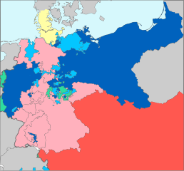
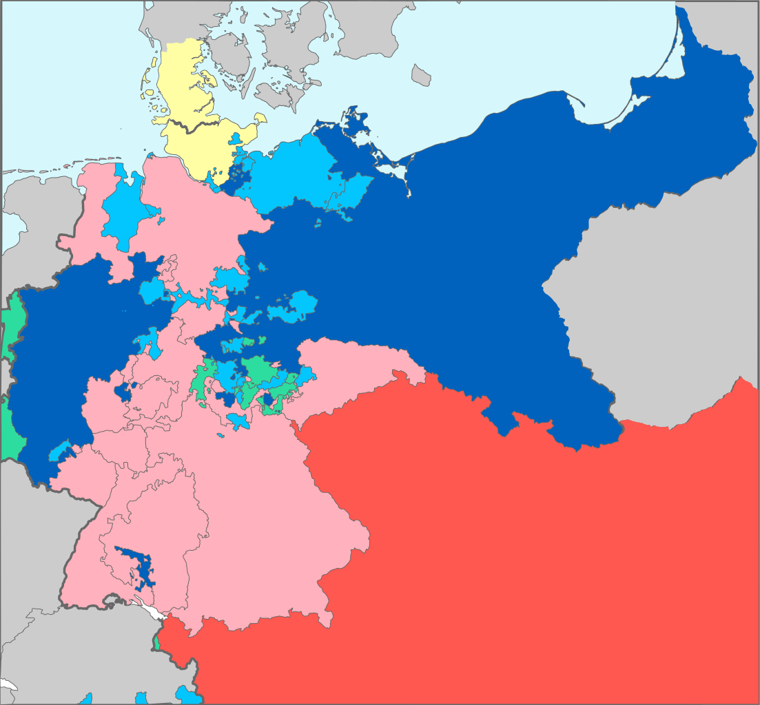
Deutsch: Bündnisse im Deutschen Bund während des Deutschen Krieges von 1866:
English: Alliances of the member-states of the en:German Confederation in the en:Austro-Prussian War, 1866
|
| Date | |
| Source | Based on map data of the IEG-Maps project (Andreas Kunz, B. Johnen and Joachim Robert Moeschl: University of Mainz) - http://www.ieg-maps.uni-mainz.de |
| Author | User:52 Pickup |
| Permission (Reusing this file) |
This file is licensed under the Creative Commons Attribution-Share Alike 2.5 Generic license.
|
File history
Click on a date/time to view the file as it appeared at that time.
| Date/Time | Thumbnail | Dimensions | User | Comment | |
|---|---|---|---|---|---|
| current | 11:40, 12 November 2016 | | 1,697 × 1,576 (790 KB) | Furfur (talk | contribs) | diese knalligen Farben sind einfach unschön, außerdem Fehlerkorrekturen: Lauenburg, Krakau |
| 12:30, 29 March 2013 |  | 1,697 × 1,576 (1.03 MB) | Knochen (talk | contribs) | more contrast. Pink is #FFC0CB Red is #FF0000 Blue is #0000FF LightBlue is #ADD8E6 | |
| 12:33, 8 December 2006 |  | 1,697 × 1,576 (1.03 MB) | 52 Pickup (talk | contribs) | {{Information| |Description= Alliances of the member-states of the former German Confederation in the Austro-Prussian War, 1866 * Prussia (dark blue) and its allies (blue) * Austria (red) and its allies ( |
You cannot overwrite this file.
File usage on Commons
The following 4 pages use this file:
File usage on other wikis
The following other wikis use this file:
- Usage on az.wikipedia.org
- Usage on ca.wikipedia.org
- Usage on cs.wikipedia.org
- Usage on de.wikipedia.org
- Usage on en.wikipedia.org
- Usage on eo.wikipedia.org
- Usage on et.wikipedia.org
- Usage on fa.wikipedia.org
- Usage on fi.wikipedia.org
- Usage on frr.wikipedia.org
- Usage on fr.wikipedia.org
- Usage on id.wikipedia.org
- Usage on it.wikipedia.org
- Usage on ka.wikipedia.org
- Usage on ko.wikipedia.org
- Usage on la.wikipedia.org
- Usage on lb.wikipedia.org
- Usage on lt.wikipedia.org
- Usage on lv.wikipedia.org
- Usage on mk.wikipedia.org
- Usage on mn.wikipedia.org
- Usage on nl.wikipedia.org
- Usage on nn.wikipedia.org
- Usage on no.wikipedia.org
- Usage on oc.wikipedia.org
- Usage on pl.wikipedia.org
- Usage on pt.wikipedia.org
- Usage on ro.wikipedia.org
- Usage on sh.wikipedia.org
- Usage on sr.wikipedia.org
- Usage on sv.wikipedia.org
- Usage on sw.wikipedia.org
- Usage on th.wikipedia.org
- Usage on tr.wikipedia.org
View more global usage of this file.