File:Cambodian-provinces-khmer.png
Jump to navigation
Jump to search
Size of this preview: 765 × 600 pixels. Other resolutions: 306 × 240 pixels | 613 × 480 pixels | 980 × 768 pixels | 1,280 × 1,003 pixels | 2,560 × 2,006 pixels | 3,000 × 2,351 pixels.
Original file (3,000 × 2,351 pixels, file size: 1.51 MB, MIME type: image/png)
Captions
Captions
Add a one-line explanation of what this file represents
Summary[edit]
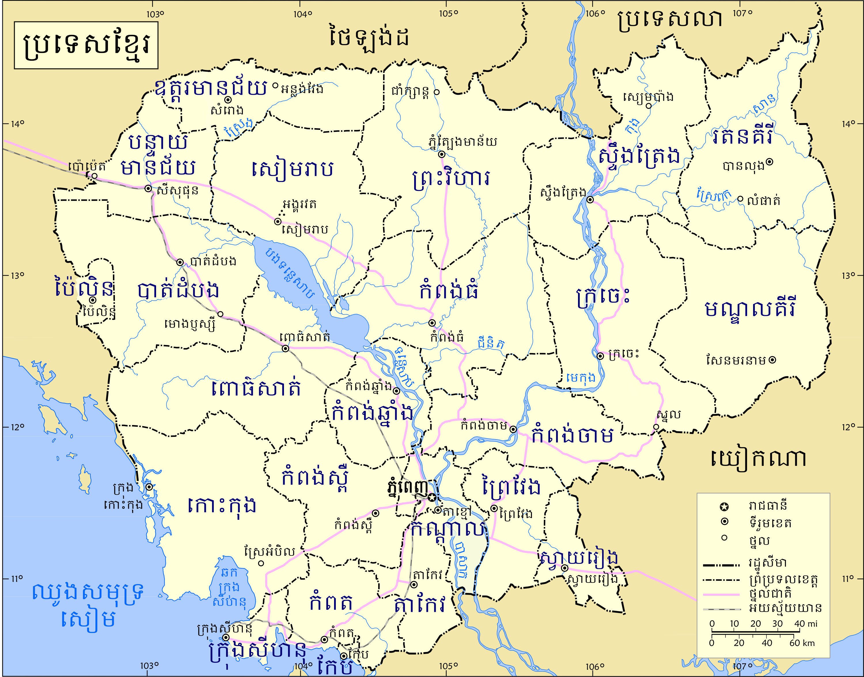
| Description | Map of Cambodia, with city and province names in Khmer |
| Date | |
| Source | self-made. Based on UN map 3860, updated and locations added. Khmer names taken from Cambodian National Institute of Statistics list of "Agreed Cambodia Area Names (Province, District, Commune) in English and Khmer" (formerly located at http://www.stats.nis.gov.kh/areaname/area_name.htm and now found at http://www.nis.gov.kh/index.php/component/content/article/18-others/10-a ) |
| Author | Rsperberg |
Licensing[edit]
| I, the copyright holder of this work, release this work into the public domain. This applies worldwide. In some countries this may not be legally possible; if so: I grant anyone the right to use this work for any purpose, without any conditions, unless such conditions are required by law. |
File history
Click on a date/time to view the file as it appeared at that time.
| Date/Time | Thumbnail | Dimensions | User | Comment | |
|---|---|---|---|---|---|
| current | 18:11, 30 January 2008 | | 3,000 × 2,351 (1.51 MB) | Rsperberg (talk | contribs) | {{Information |Description=Map of Cambodia, with city and province names in Khmer |Source=self-made |Date=01/30/2008 |Author= Rsperberg (~~~) |other_versions= }} Category:Maps of Cambodia |
You cannot overwrite this file.
File usage on Commons
The following 3 pages use this file:
File usage on other wikis
The following other wikis use this file:
- Usage on bg.wikipedia.org